
Катание на привязанной к лодке надувной "таблетке". Коля усиленно пытается на ней удержаться. Озеро Вашингтон в одноимённом штате, лето 2007.
Kolya is trying to stay attached to the "high-speed flotation device". Lake Washington, WA, summer 2007.
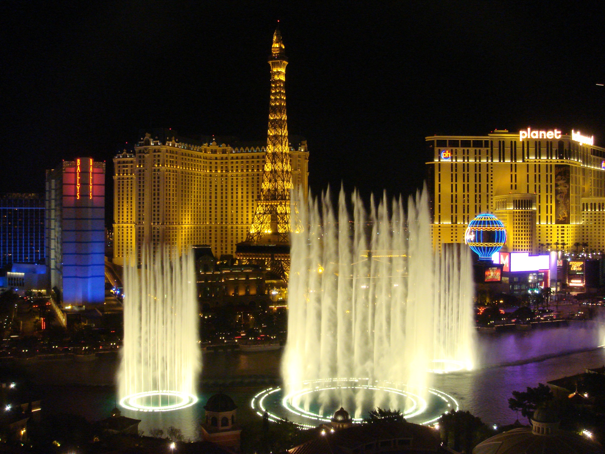
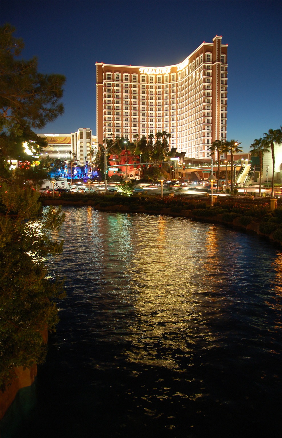
Поющие фонтаны, вид из отеля Bellagio. Лас-Вегас, штат Невада. Август 2007.
Singing fountains as seen from the Bellagio Hotel in Las Vegas, NV. August 2007.
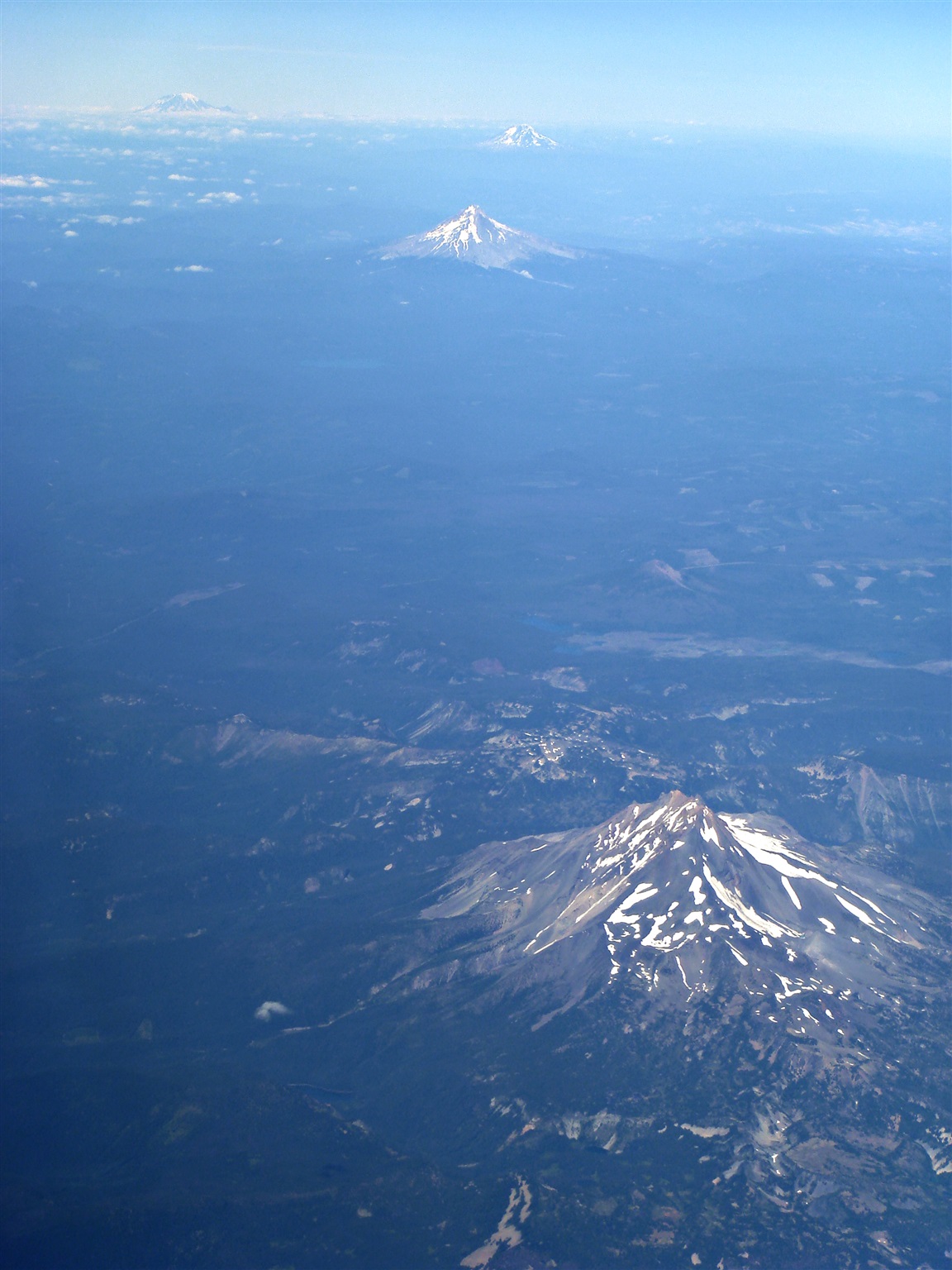
Пролетая над штатом Орегон, я увидел эти четыре вулкана, выстроившиеся в ряд длиною в 260 километров. Снизу вверх: Джефферсон, Худ (Майнт-Худ), Адамс, и Рейнир. Август 2007.
Flying above Oregon, I saw 4 big volcanoes lined up over the distance over 160 miles: Mt. Jefferson, Mt. Hood, Mt. Adams, and Mt Rainier. August 2007.
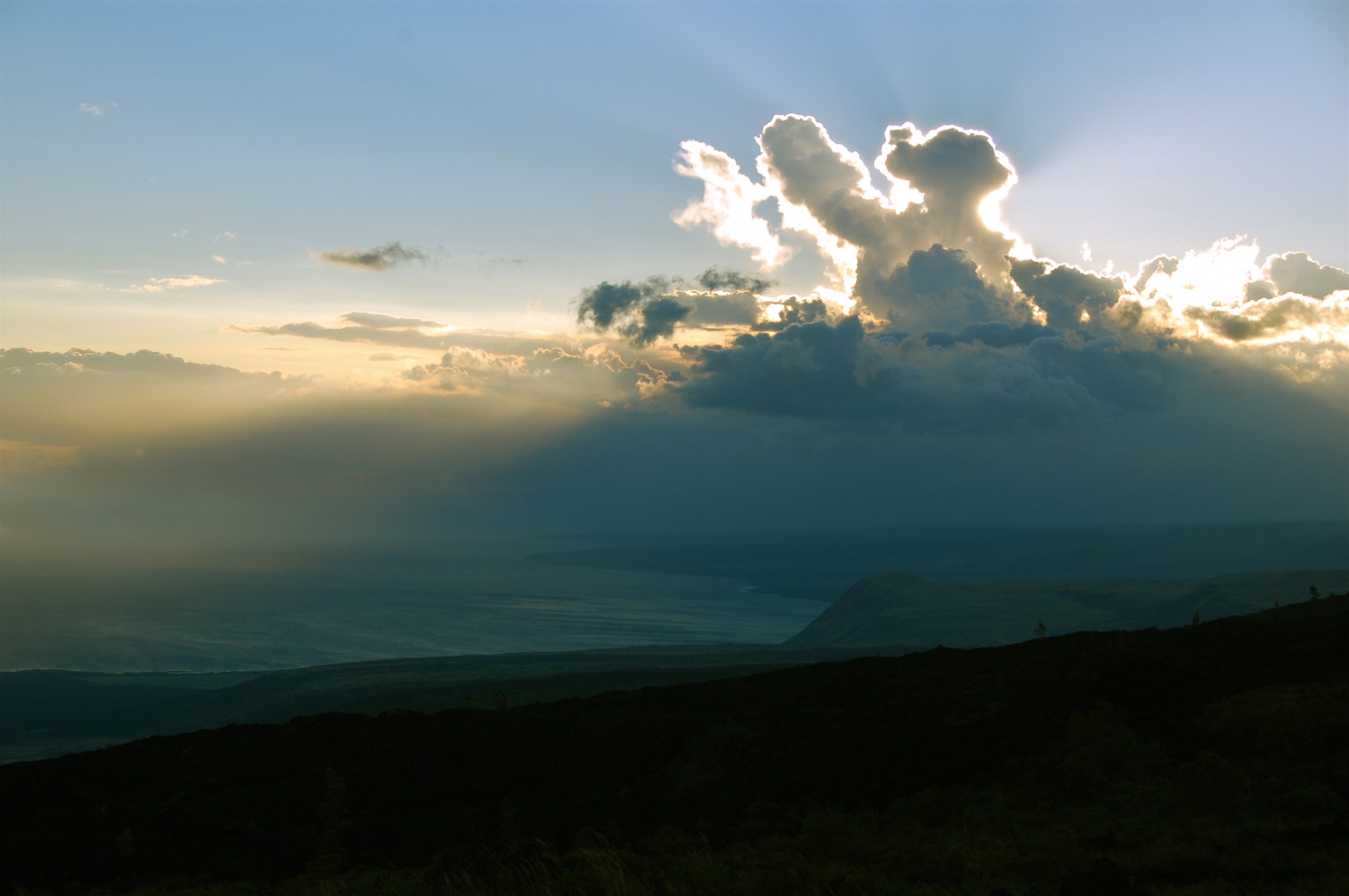
Закат солнца на острове Гавайи (Big Island), южное побережье. Ноябрь 2007.
Sunset on the Big Island, Hawaii. The camera is looking south-west from Chain of Craters Road at the southern part of Hawaii Volcanoes National Park. November 2007.
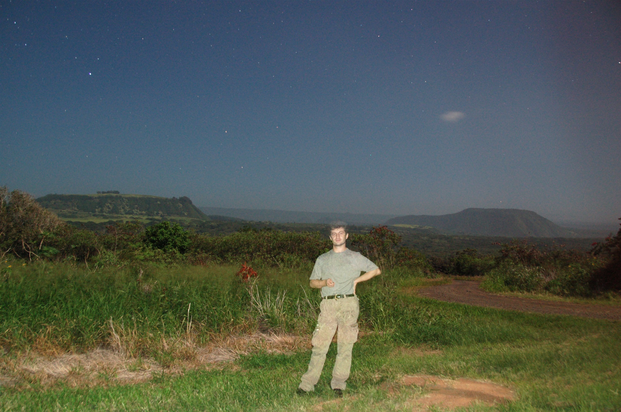
Остров Гавайи (Big Island), примерно здесь: http://maps.live.com/default.aspx?v=2&cp=19.152101~-155.510273&style=a&lvl=14&tilt=-90&dir=0&alt=-1000&sp=Point.m5qsbc216h0x_1___&encType=1. Ночной кадр с двойной экспозицией. Ноябрь 2007.
Big Island, Hawaii, this point: http://maps.live.com/default.aspx?v=2&cp=19.152101~-155.510273&style=a&lvl=14&tilt=-90&dir=0&alt=-1000&sp=Point.m5qsbc216h0x_1___&encType=1. This is a double exposure night picture.
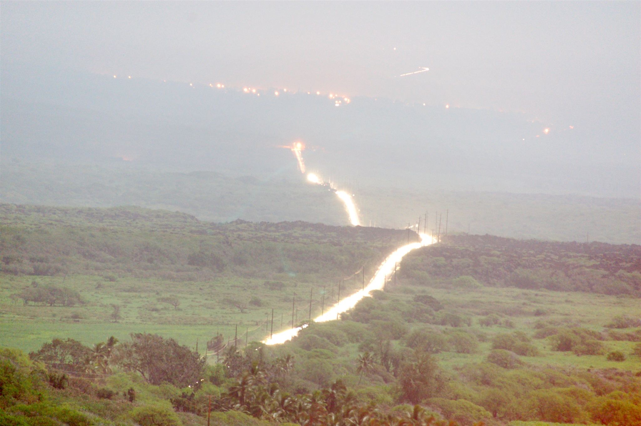
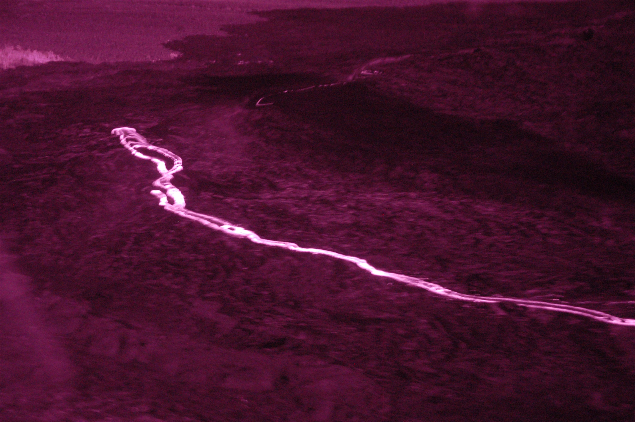
Примерно 50 километров ночного воздуха, залитого паразитным светом от трассы №11 и городков. 146 секунд экспозиции. Вид на северо-восток с возвышенности чуть южнее городка Хонуапо (Honuapo) на острове Гавайи (Big Island). Ноябрь 2007.
Here you see 30 miles of the night air, polluted with the light from highway 11 and small cities. This view is towards the north-east from elevated view point slightly souther of Honuapo, Big Island, HI. 146 seconds of exposure, November 2007.
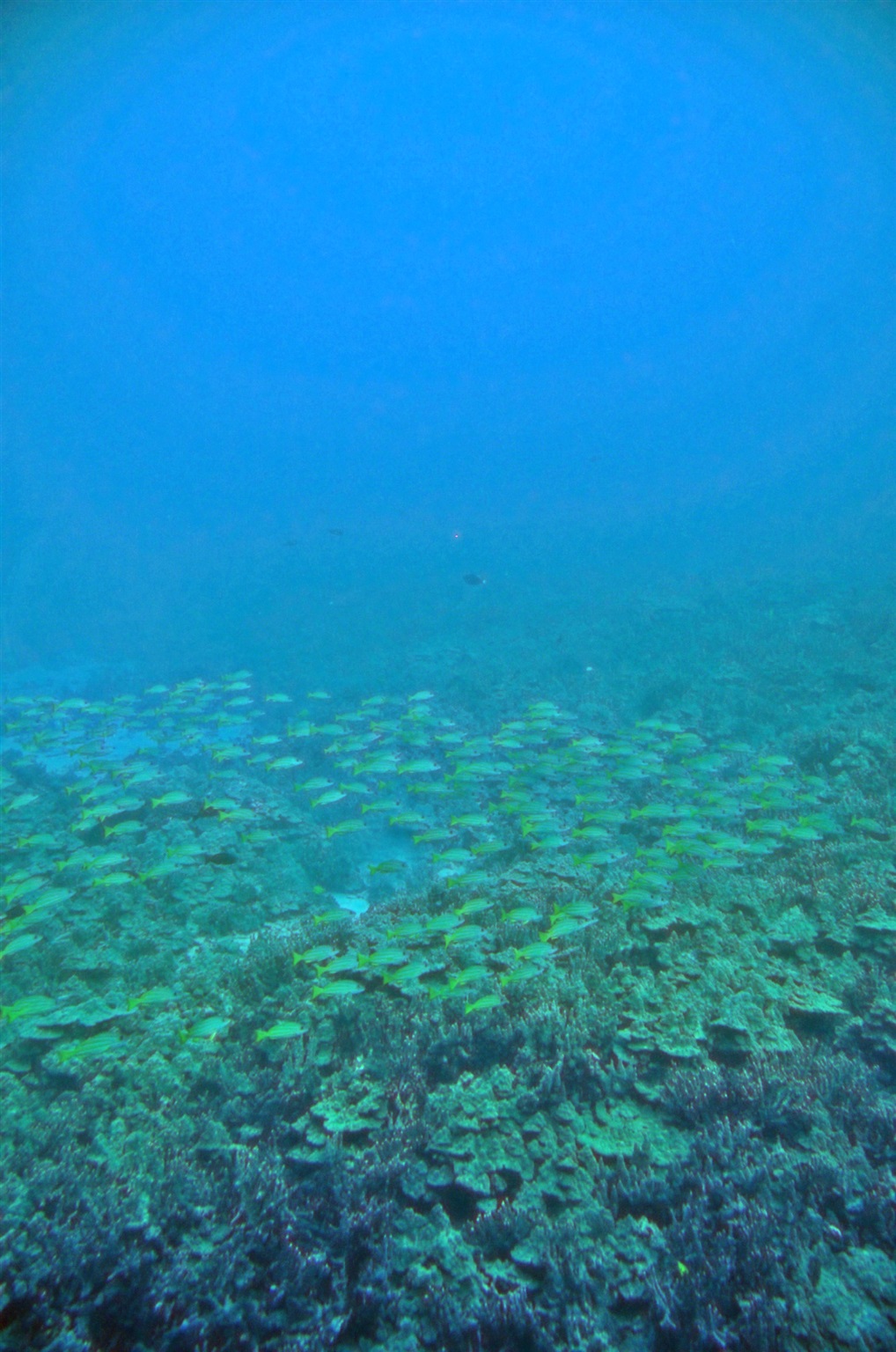
Косяк рыбы на глубине примерно 25 метров в океане напротив города Каилуа Кона (Kailua Kona), остров Гавайи (Big Island). Ноябрь 2007.
Shoal of fish at 80 feet depth in the Pacific ocean across Kailua Kona, Big Island, HI. November 2007.
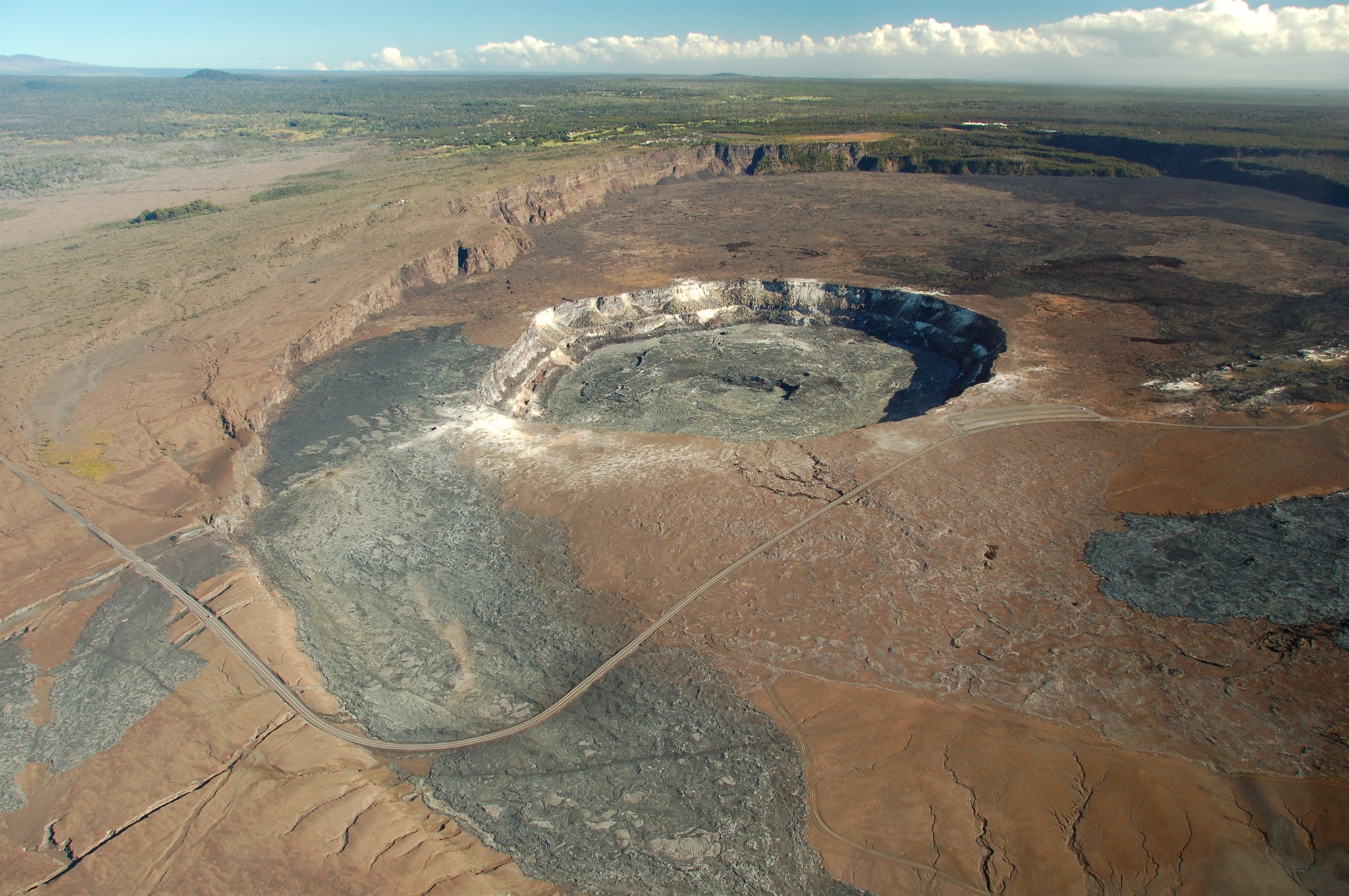
Кратер вулканического происхождения на острове Гавайи (Big Island). Вот здесь: http://maps.live.com/default.aspx?v=2&cp=19.405078~-155.28471&style=h&lvl=15&tilt=-90&dir=0&alt=-1000&encType=1
Volcanic crater on Big Island, Hawaii, at this point: http://maps.live.com/default.aspx?v=2&cp=19.405078~-155.28471&style=h&lvl=15&tilt=-90&dir=0&alt=-1000&encType=1.
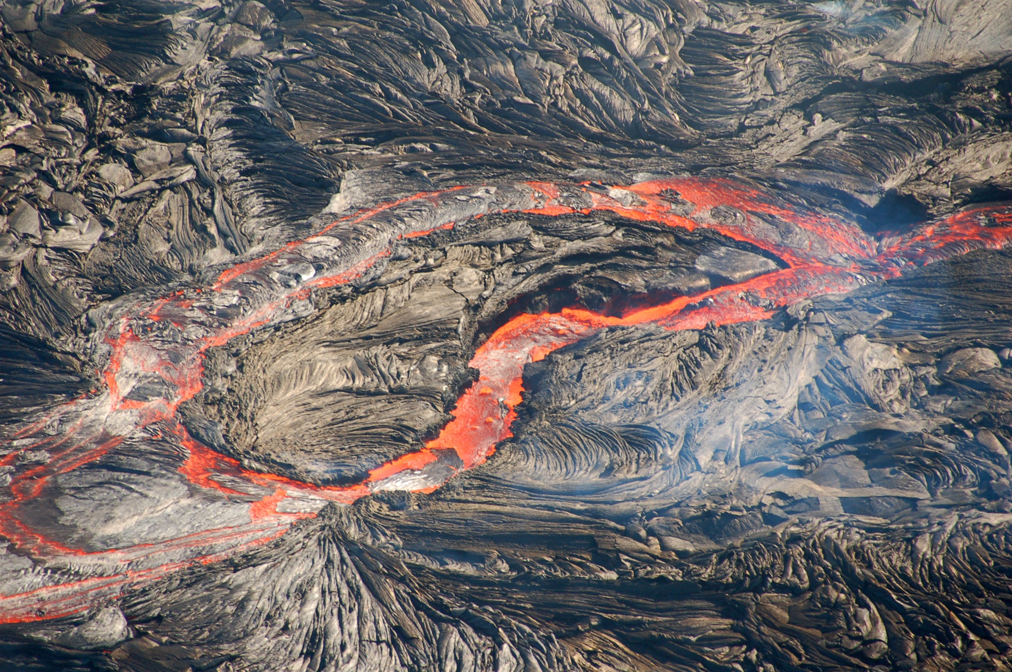
Вид с вертолёта на потоки бегущей лавы. Ширина этих "рек" -- несколько метров, и движутся они на удивление быстро. Остров Гавайи (Big Island), примерно вот этот район: http://maps.live.com/default.aspx?v=2&cp=19.355121~-155.190382&style=h&lvl=14&tilt=-90&dir=0&alt=-1000&encType=1. Ноябрь 2007.
Lava flow on the Big Island, Hawaii, seen from the helicopter in this area: http://maps.live.com/default.aspx?v=2&cp=19.355121~-155.190382&style=h&lvl=14&tilt=-90&dir=0&alt=-1000&encType=1.
Lava was surprisingly swift and was moving very fast, like water in the fiver. November 2007.
Остров Гавайи (Big Island), восточное побережье. Ноябрь 2007.
Eastern shore of Big Island, Hawaii. November 2007.
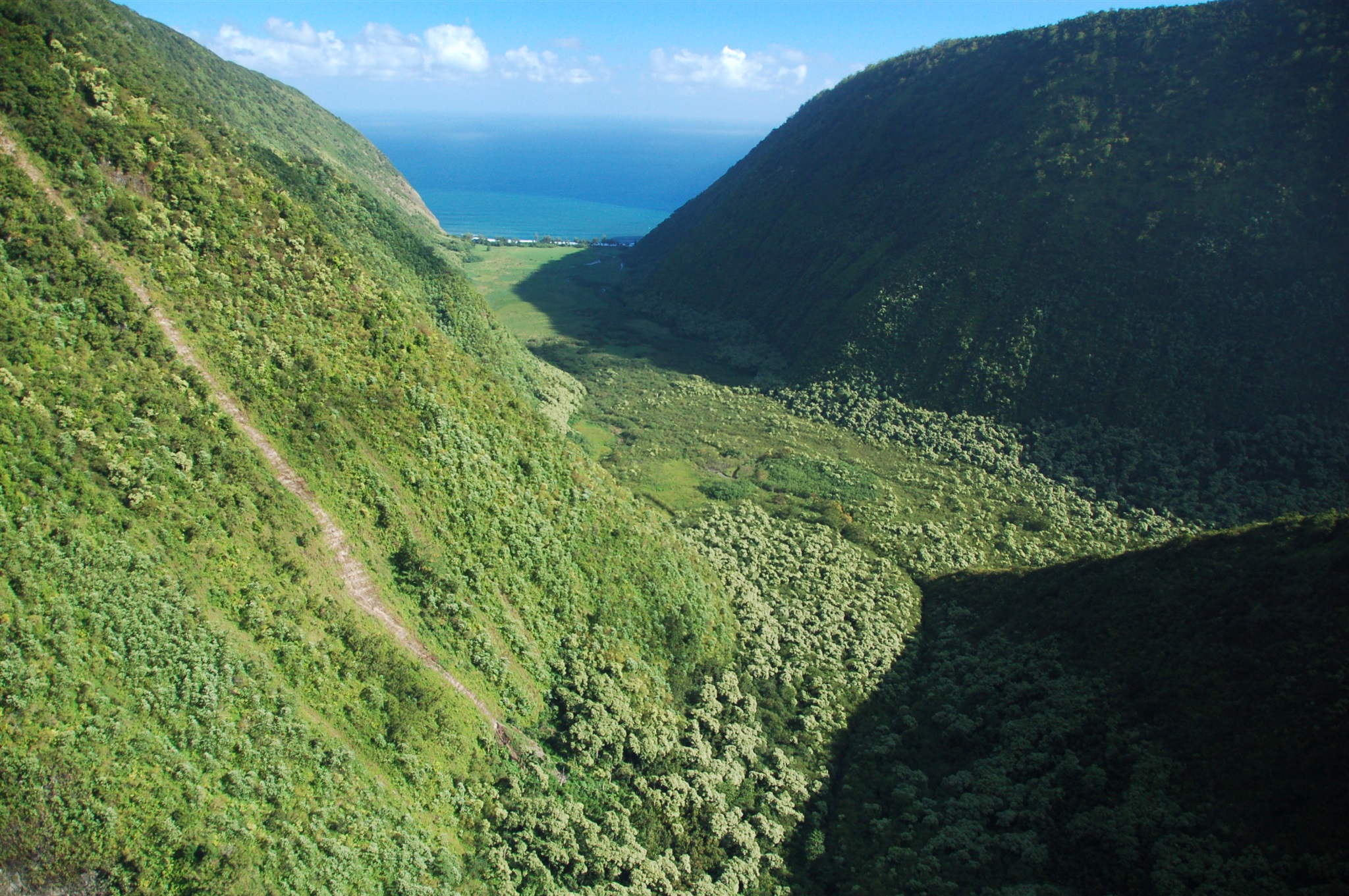
Остров Гавайи (Big Island), восточное побережье. Ноябрь 2007.
Eastern shore of Big Island, Hawaii. November 2007.
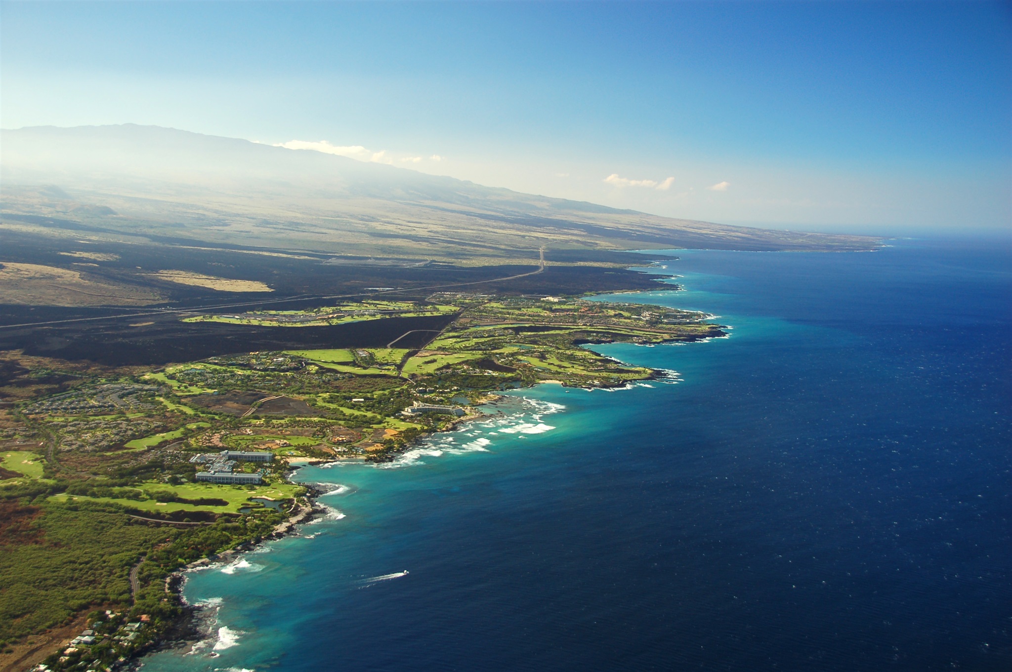
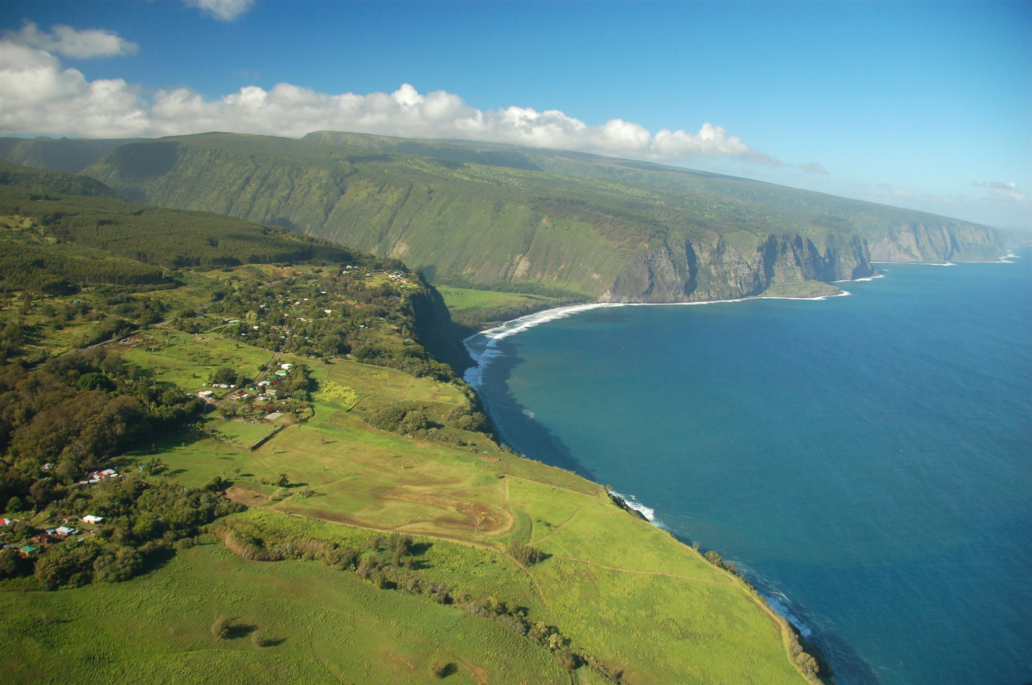
Остров Big Island, Гавайи, северная часть западного побережья. Ноябрь 2007.
Big Island, Hawaii, northern part of the western shore. November 2007.
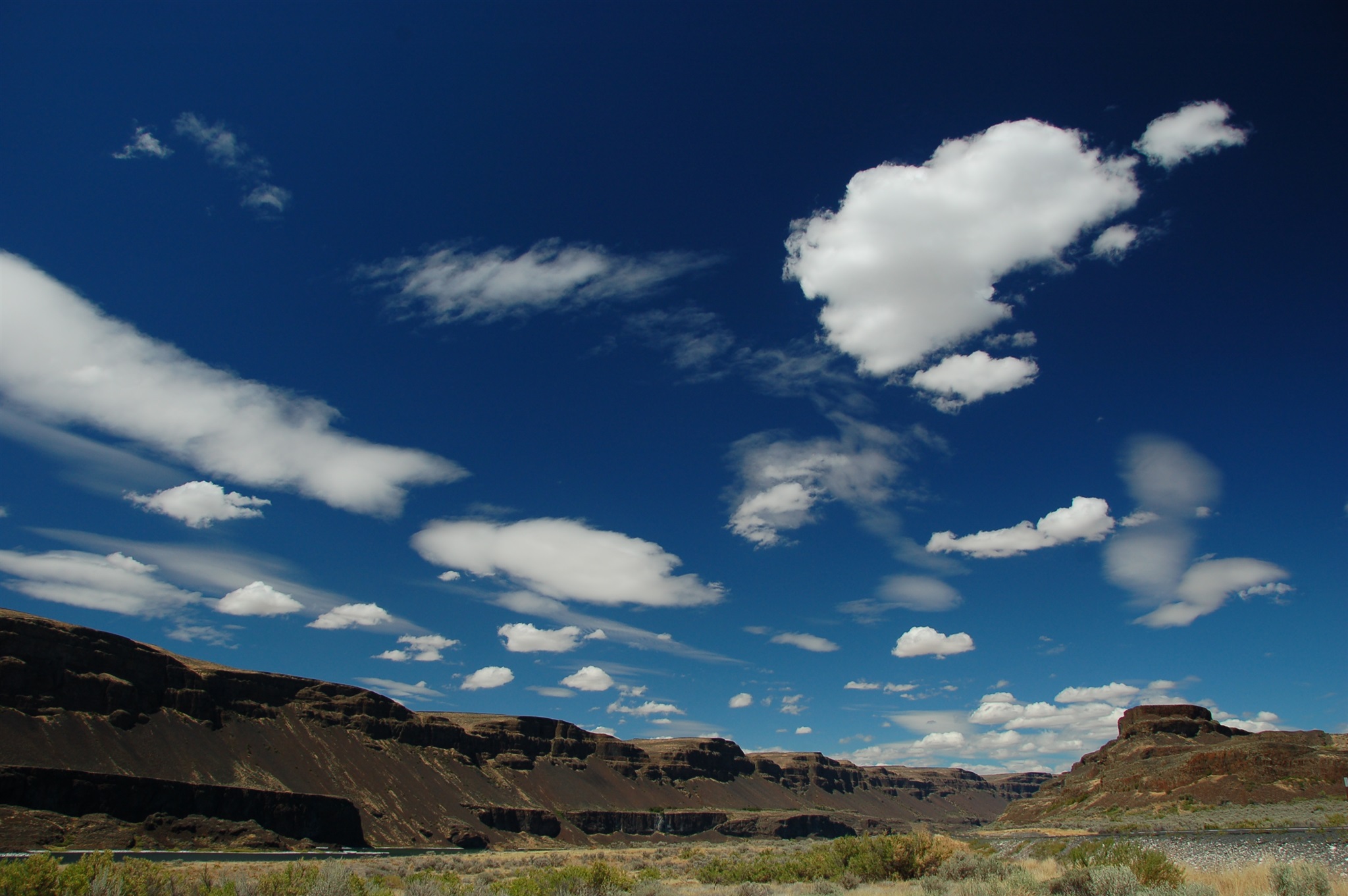
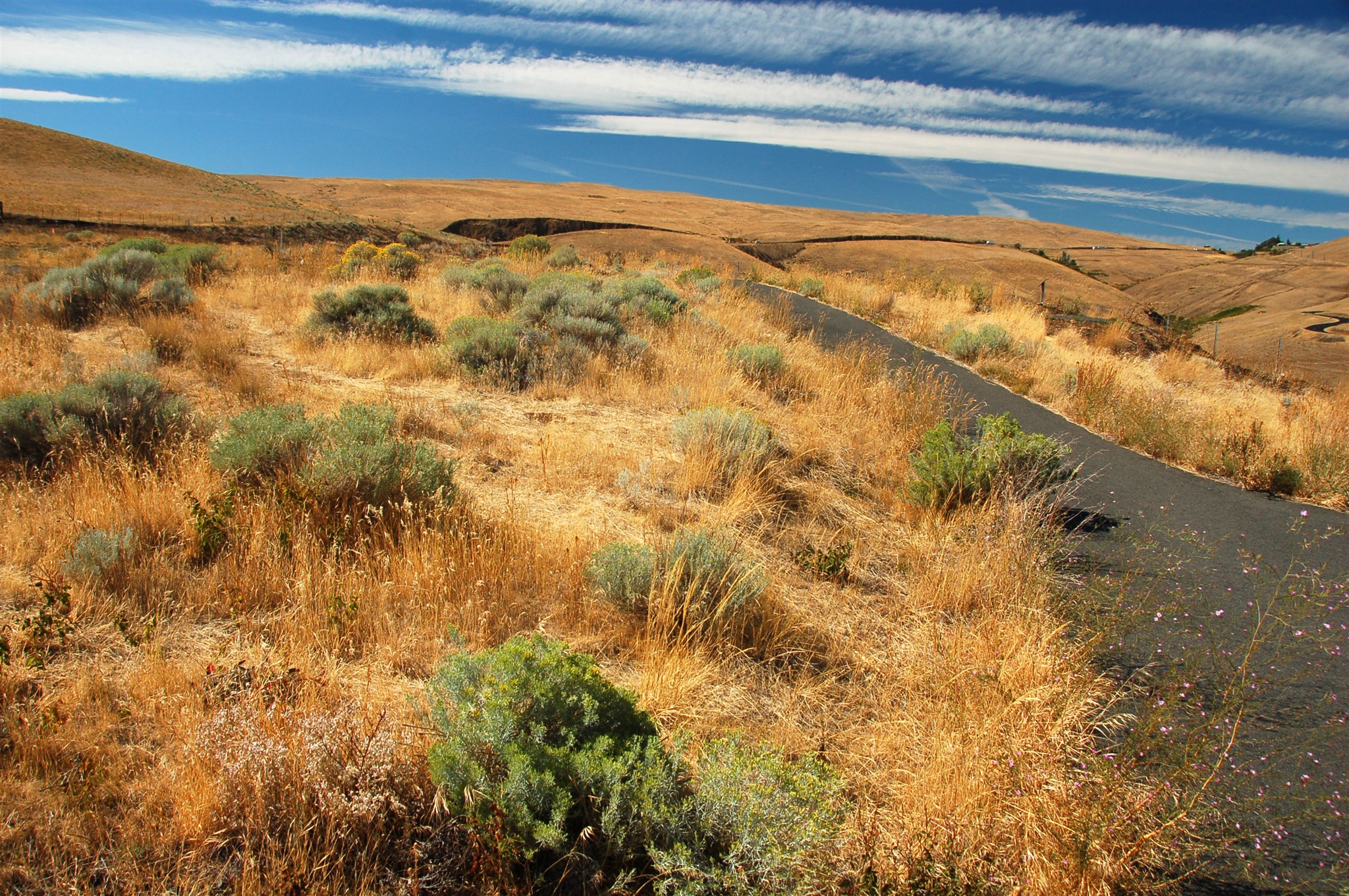
Восточные районы штата Вашингтон, озёра Sun Lakes. Июль 2007.
Sun Lakes area, Eastern Washington, WA. July 2007.
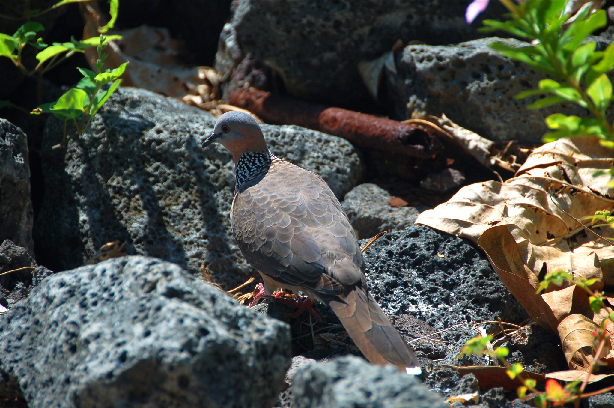
Птица, очень похожая на обитающую в России и Средней Азии горлицу... но почти вдвое меньшая! Живёт на острове Гавайи (Big Island). Ноябрь 2007.
Hawaiian bird. November 2007.
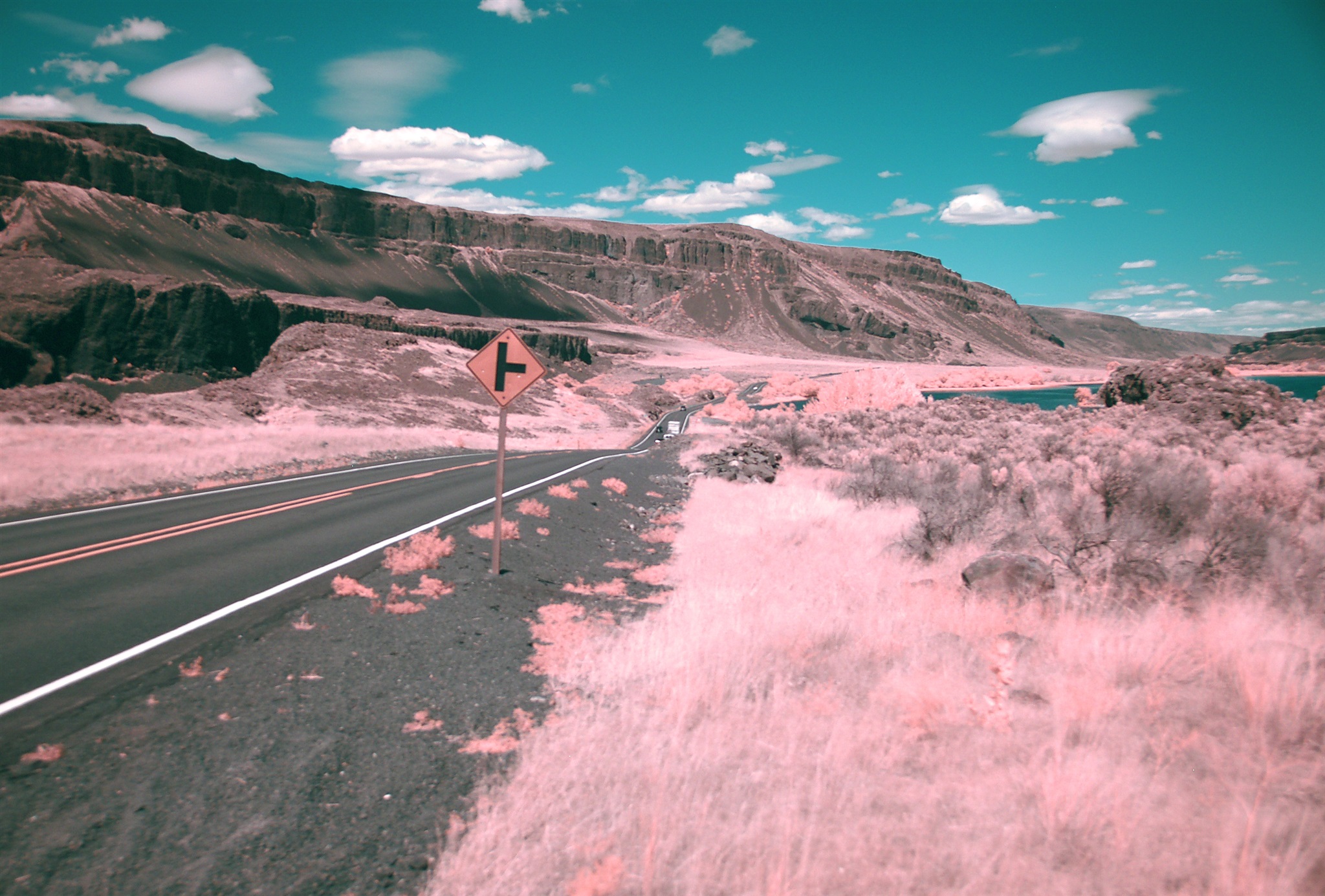
Восточные районы штата Вашингтон, озёра Sun Lakes. Июль 2007. Инфракрасно-сине-зелёный кадр.
Sun Lakes area, Eastern Washington, WA. July 2007. The picture is taken in inrfared, green, and blue light.

Бухта Кеаухоу (Keauhou) на острове Гавайи (Big Island). Ноябрь 2007.
Keauhou Bay, Big Island, Hawaii. November 2007.
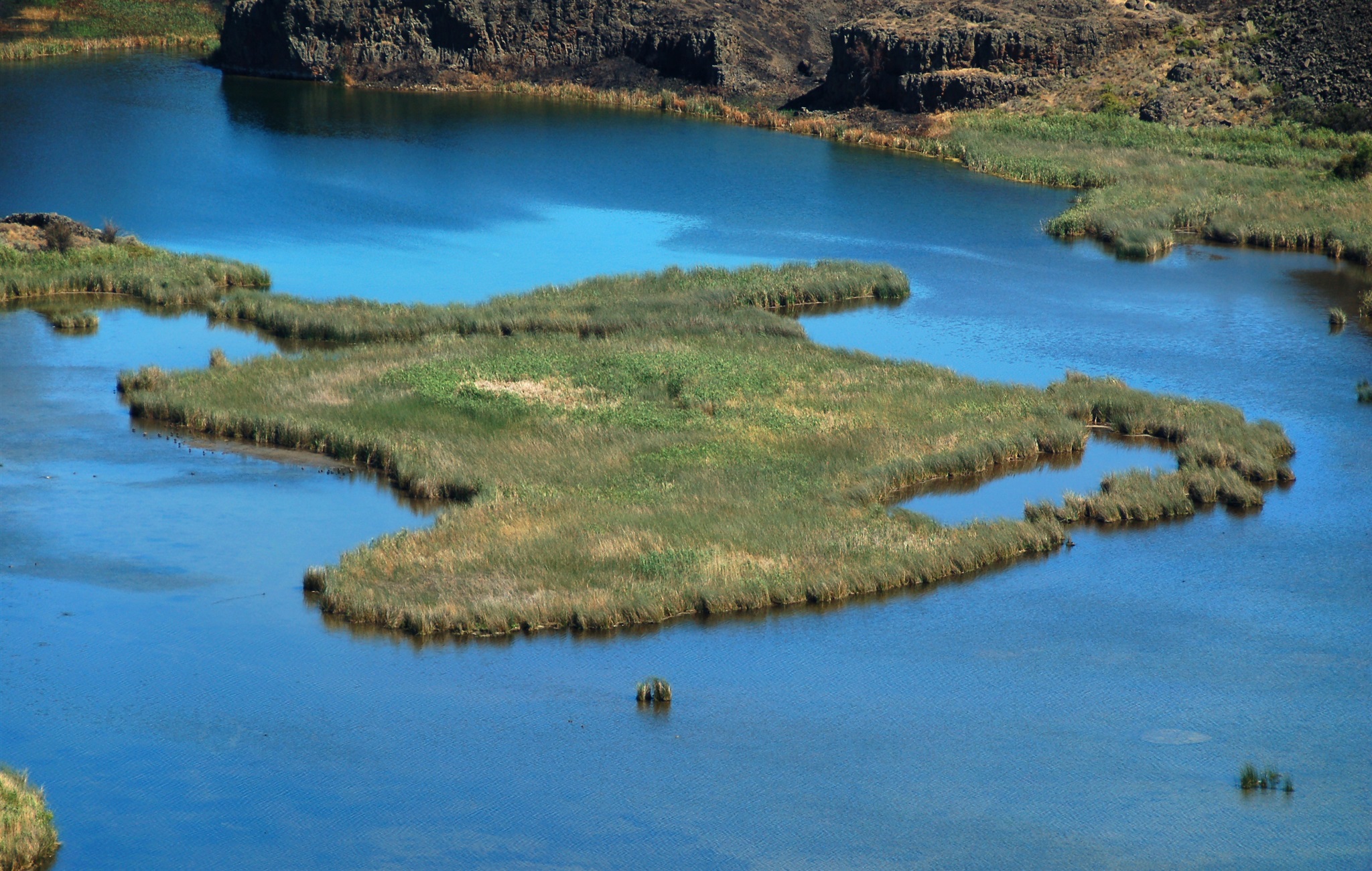
Озеро на дне каньона Dry Falls ("высохшие водопады") в восточной части штата Вашингтон, область Sun Lakes. Июль 2007.
Lake at the bottom of Dry Falls canyon in Sun Lakes area, Eastern Washington, WA. July 2007.
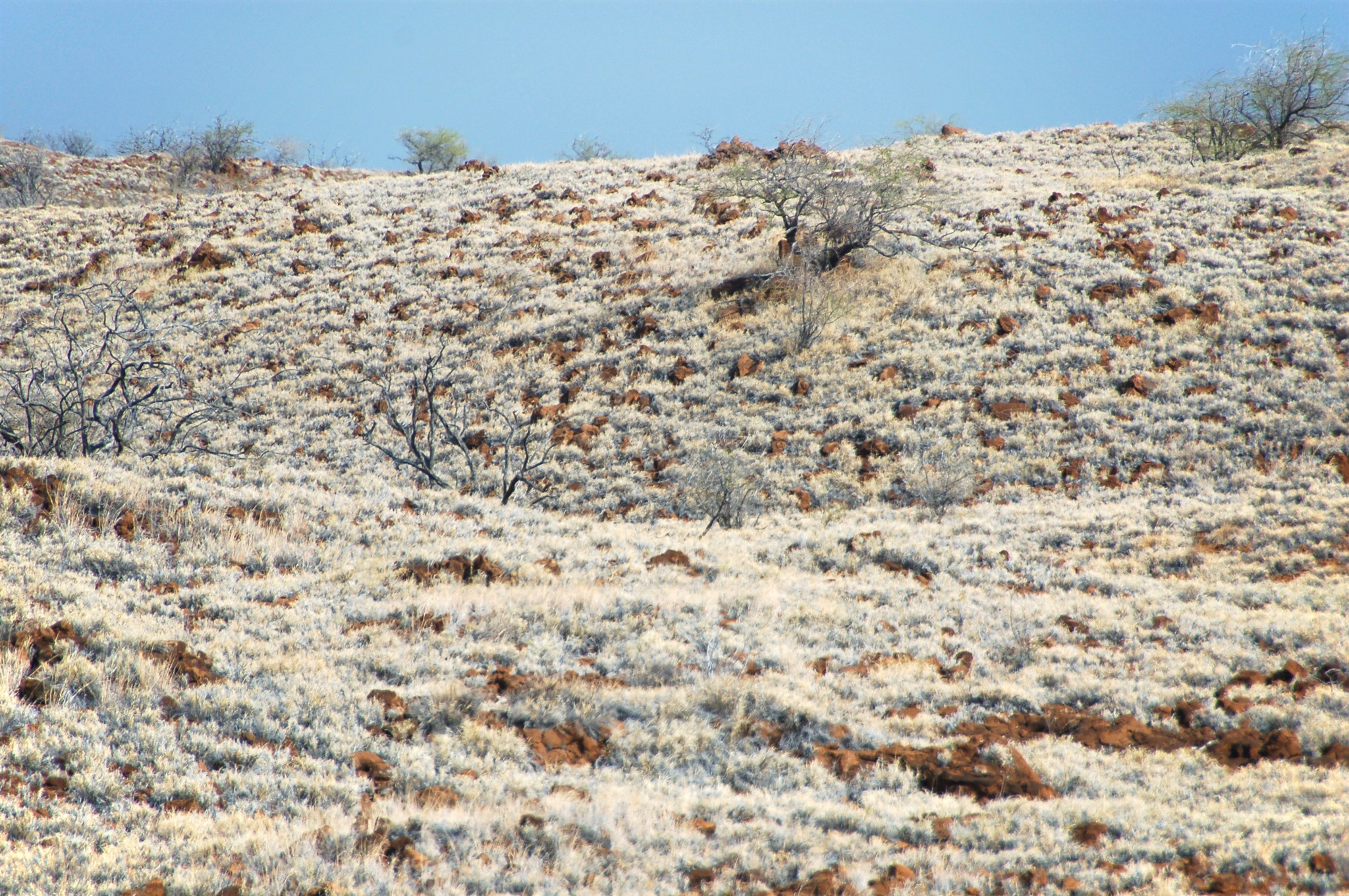
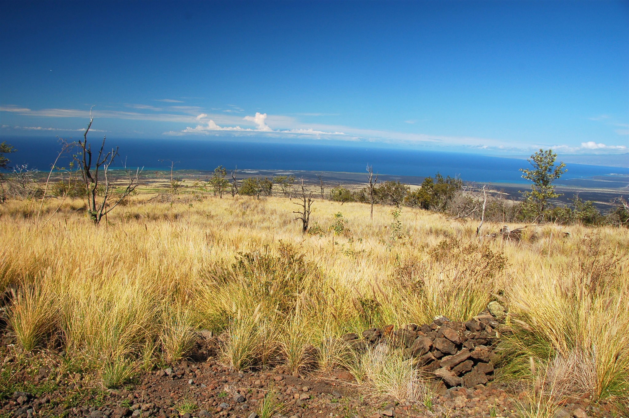
Холмистые степи в северо-западной части острова Гавайи (Big Island). Ноябрь 2007.
Hills of the north-west part of Big Island, Hawaii. November 2007.
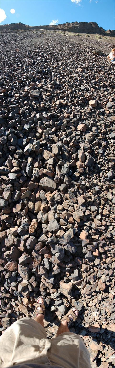
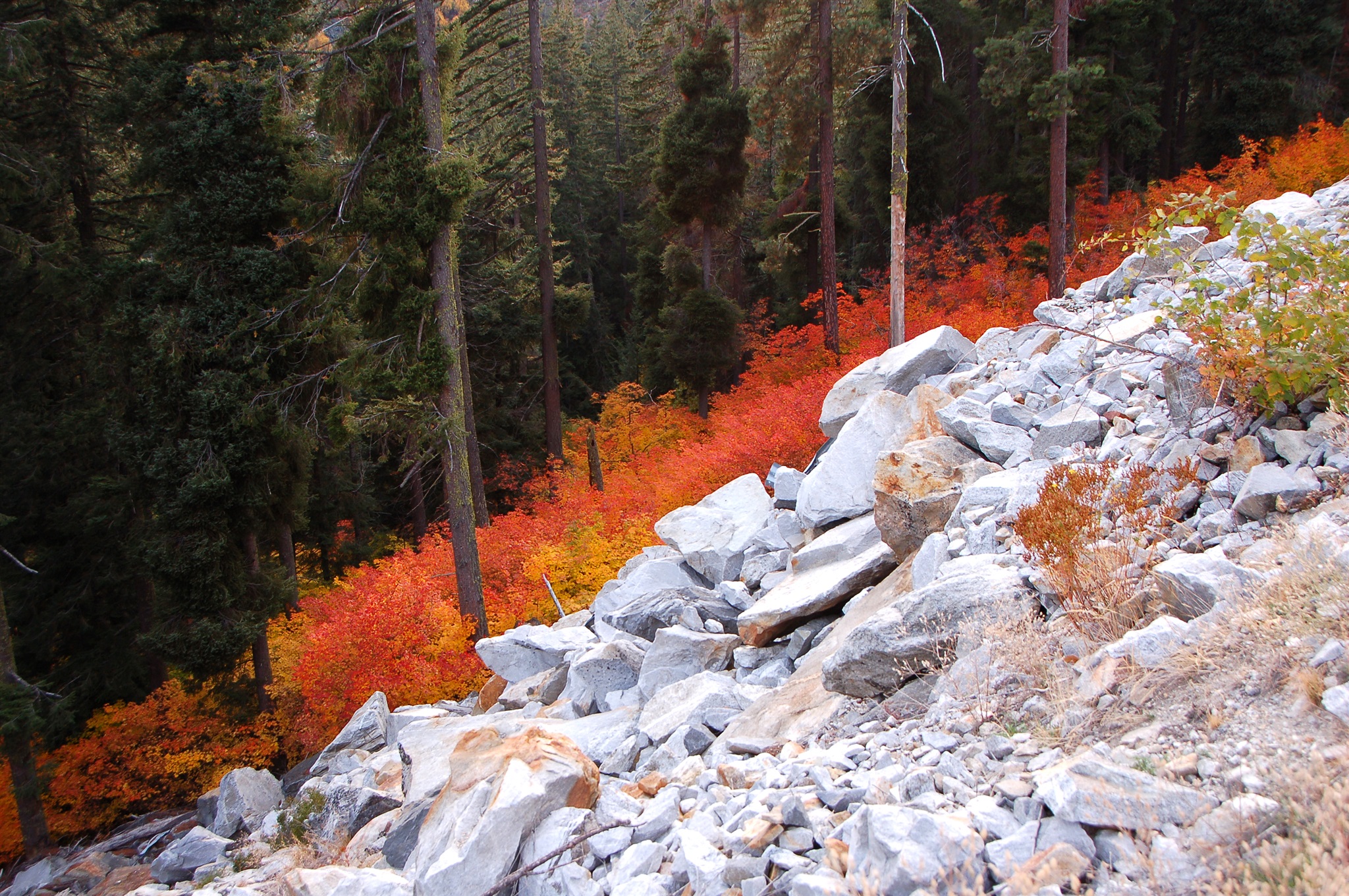
135-градусная вертикальная панорама каменной осыпи в районе возле Солнечных Озёр (Sun Lakes) в восточной части штата Вашингтон. Июль 2007.
135-gedree vertical panoramic view of rock slide in Sun Lakes area, Eastern Washington, WA. July 2007.
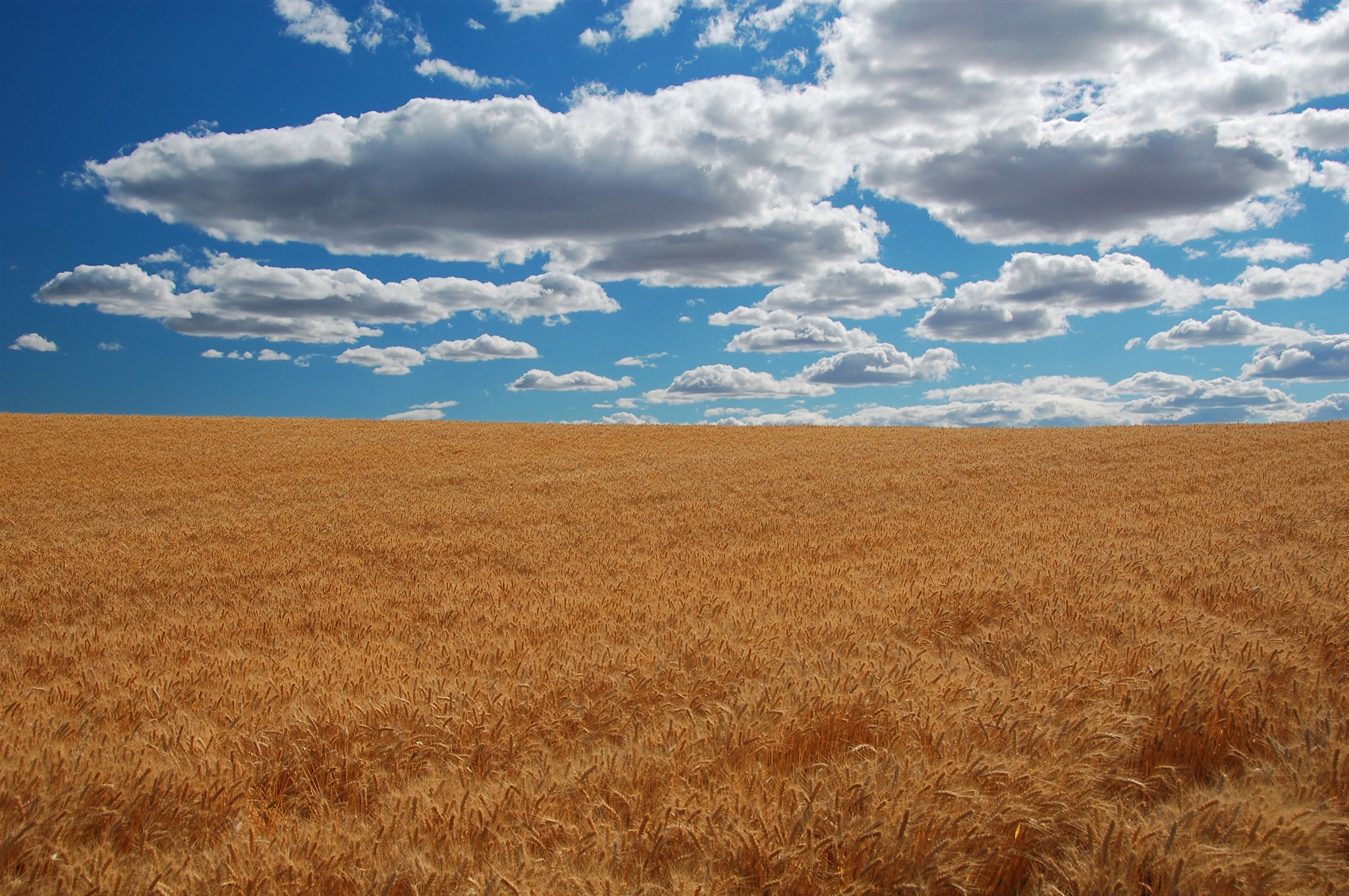
Поля в окрестностях городка Barid вдоль трассы №2, восточный Вашингтон, июль 2007.
Fields near Barid seen from highway 2, Eastern WA, July 2007.
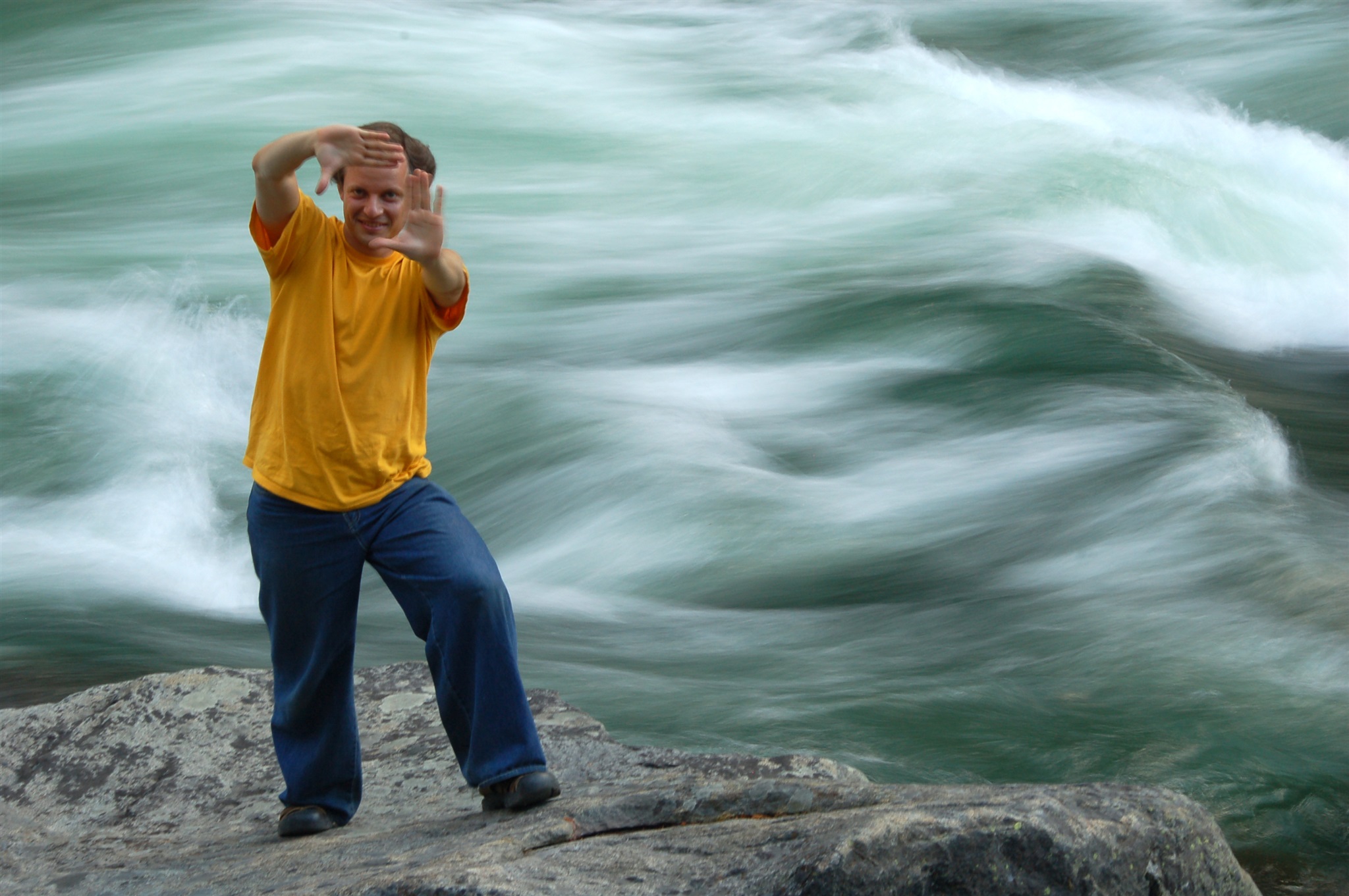
Андрей позирует на фоне бурных вод реки Wenatchee в паре миль к востоку от города Leavenworth, штат Вашингтон. Июль 2007.
Andrew posing on the background of furious Wenatchee river couple miles east of Leavenworth, WA. July 2007.
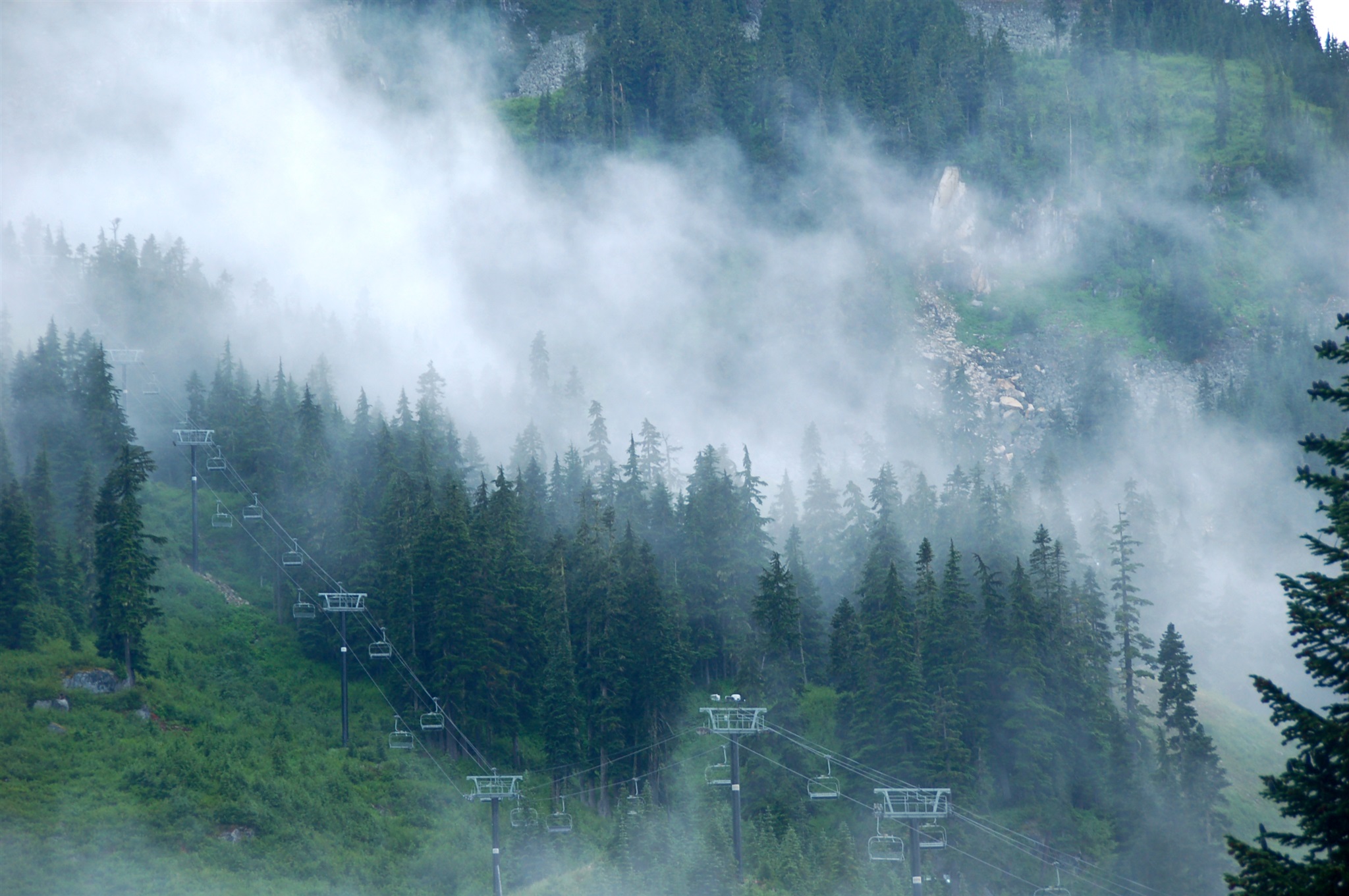
Туман на перевале Стевенс (Stevens Pass), штат Вашингтон, июль 2007.
Misty Stevens Pass, WA, July 2007.
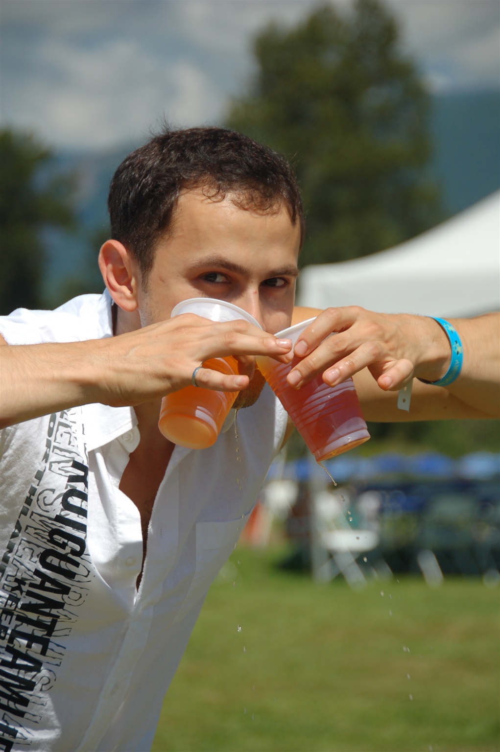
Миша пытается пить пиво из двух бокалов сразу. Корпоративная попойка компании Microsoft на природе, окрестности городка North Bend, штат Вашингтон, июль 2007.
Michael is drinking beer from two glasses at the same time. Microsoft Company picnic near North Bend, WA, July 2007.
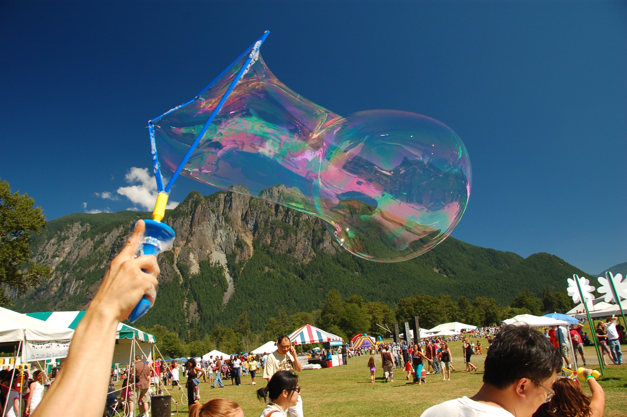
Запуск мыльного пузыря. Корпоративная попойка компании Microsoft на природе, окрестности городка North Bend, штат Вашингтон, июль 2007.
Soap bubble. Microsoft Company picnic near North Bend, WA, July 2007.
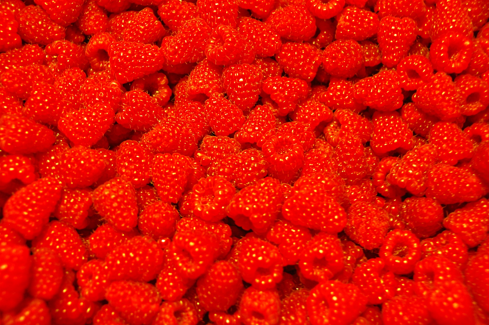
Малина. Лето 2007.
Raspberries, summer 2007.
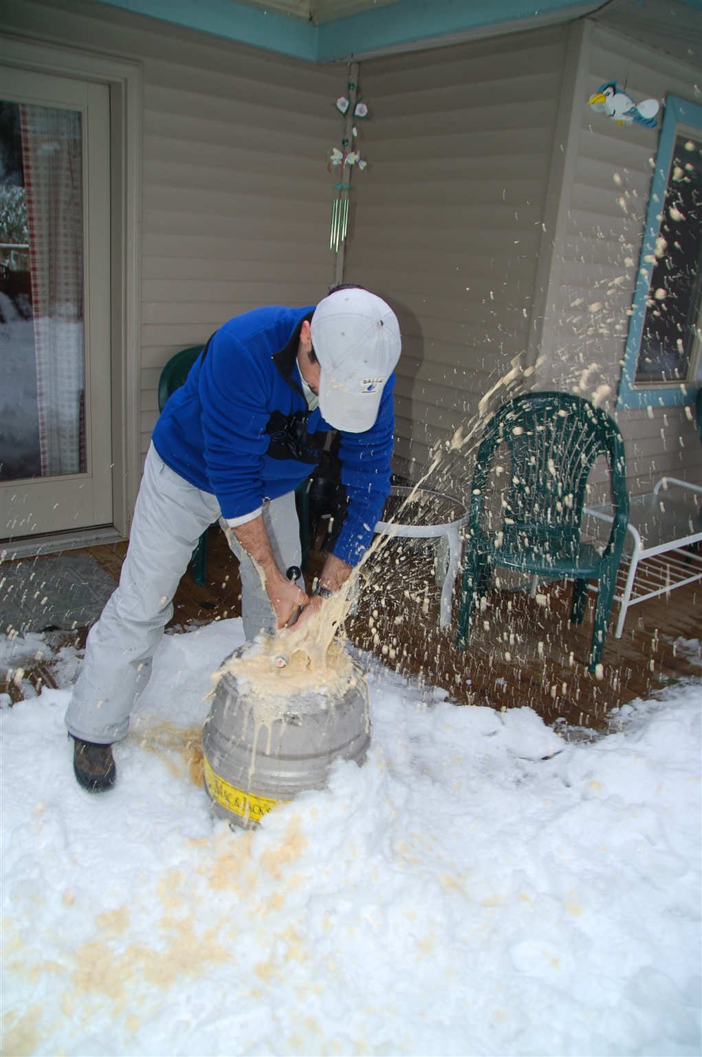
Дима открывает бочонок с пивом, а пиво радостно вырывается на свободу. 29 декабря 2007 года, окрестности горы Baker, примерно здесь: http://maps.live.com/default.aspx?v=2&cp=48.891556~-121.92436&style=r&lvl=16&tilt=-90&dir=0&alt=-1000&scene=2852814&sp=Point.s4frpz4v5rrf_1___&encType=1.
Dmitry is opening the beer keg... and the beer runs for the feedom ;) The photo was taken in a rental house near Mt. Baker, approximately here: http://maps.live.com/default.aspx?v=2&cp=48.891556~-121.92436&style=r&lvl=16&tilt=-90&dir=0&alt=-1000&scene=2852814&sp=Point.s4frpz4v5rrf_1___&encType=1.
December, the 29th, 2007.
Окрестности горы Бейкер (Baker), штат Вашингтон. 29 декабря 2007 года.
Near Mt. Baker, WA, 12/29/2007.
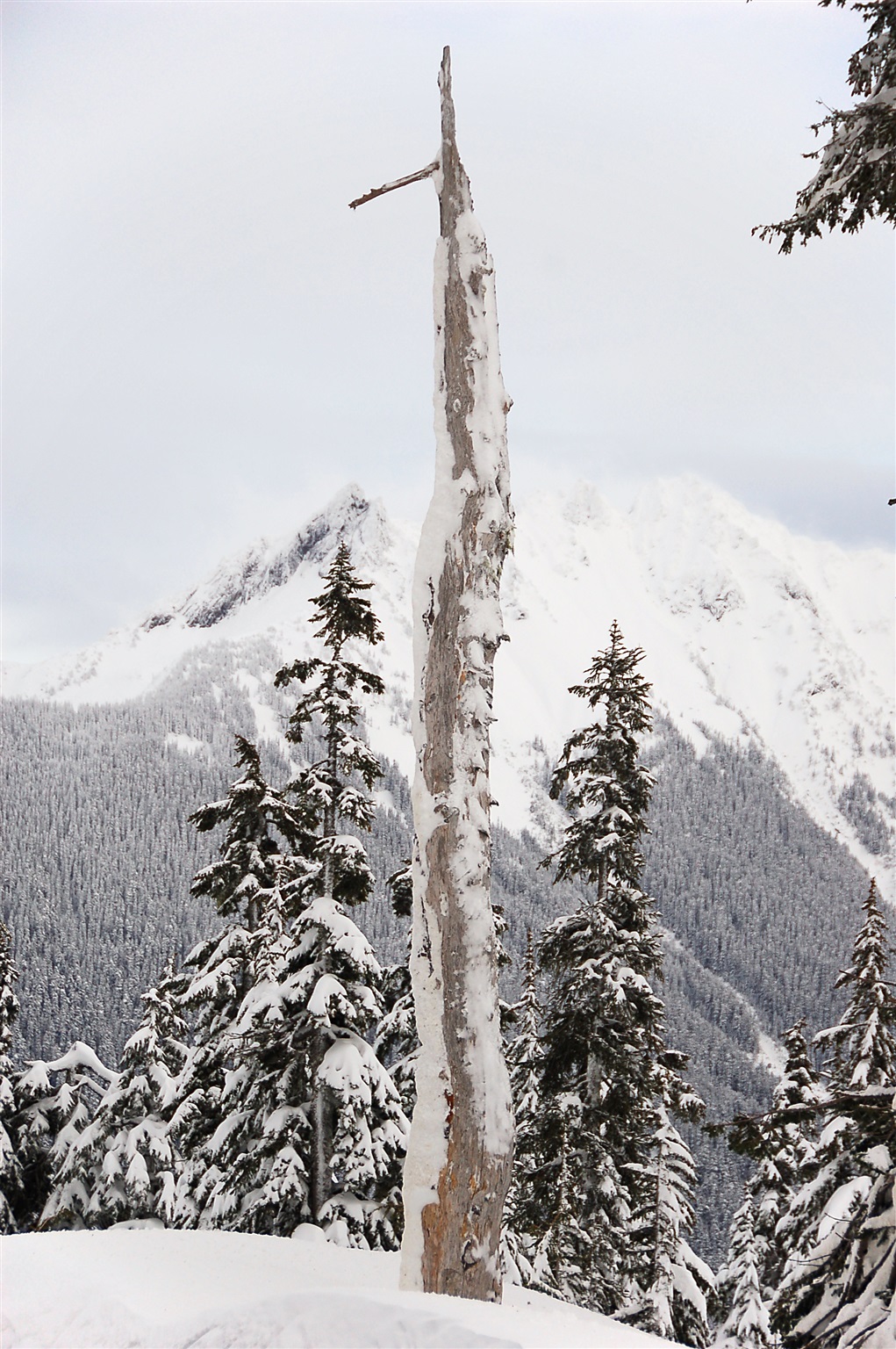
Окрестности горы Бейкер (Baker), штат Вашингтон. 31 декабря 2007 года.
Near Mt. Baker, WA, 12/31/2007.
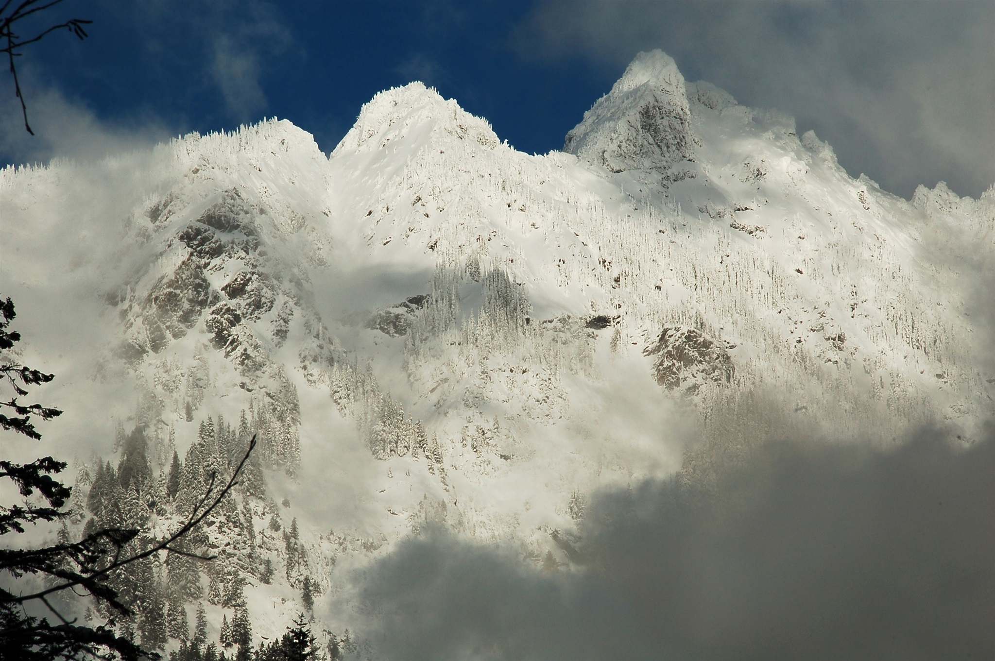
Окрестности горы Бейкер (Baker), штат Вашингтон. 31 декабря 2007 года.
Near Mt. Baker, WA, 12/31/2007.
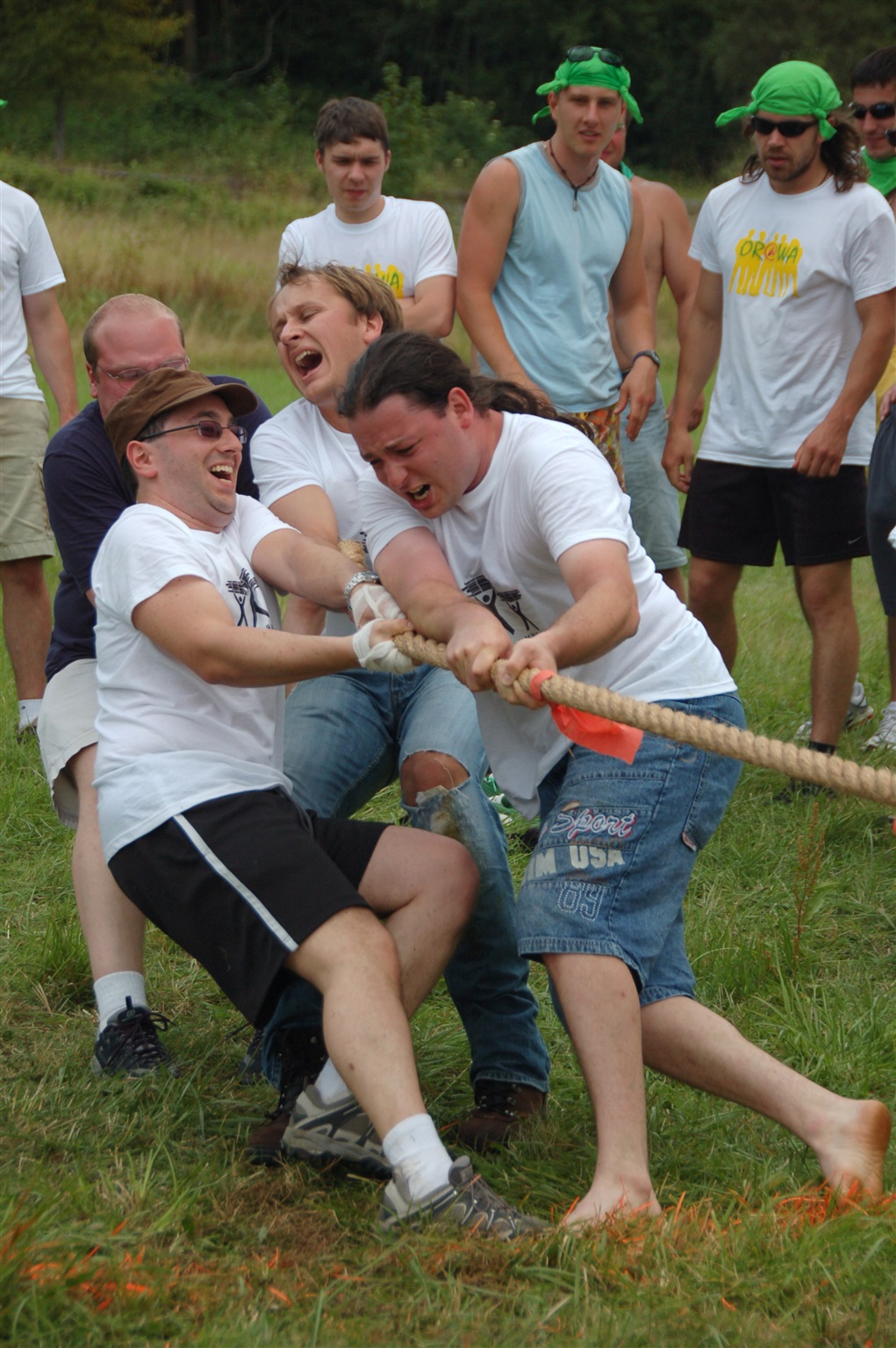
Перетягивание каната на турслёте "ДроWA" в августе 2007 года. Наша команда побеждает, но какой ценой -- вы только взгляните на эти лица!
Rope pulling contest at DroWA cultural event in August 2007. These people are winning, but just look at their faces!
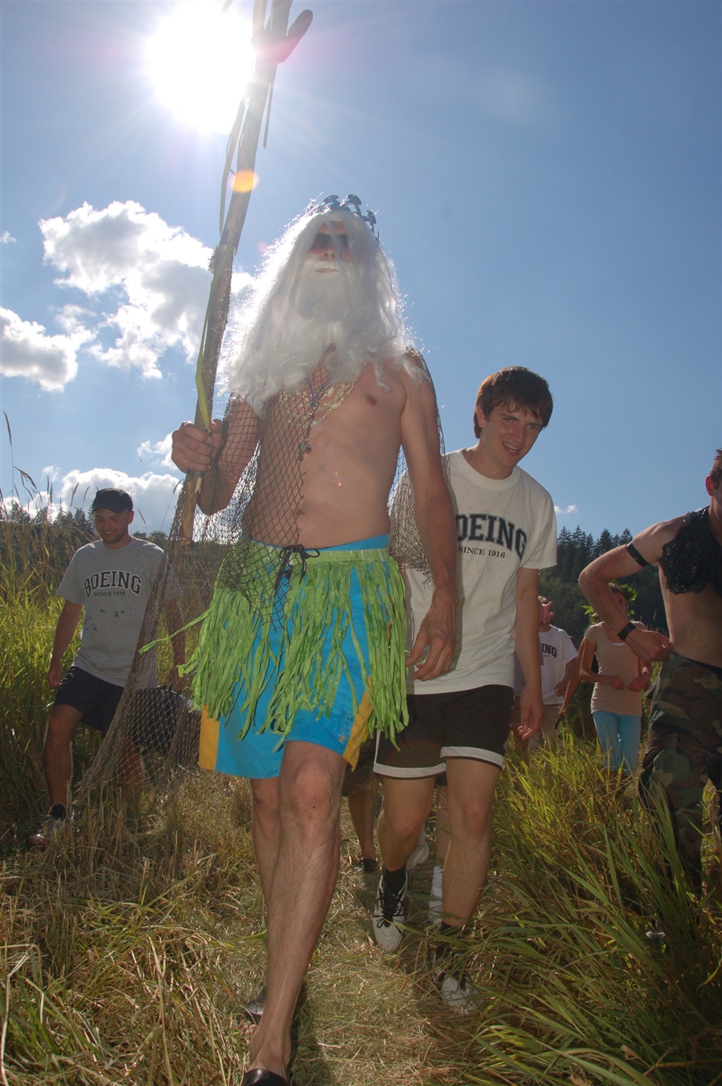
Шествие Нептуна на турслёте "ДроWA" в августе 2007 года.
Neptune procession at DroWA cultural event in August 2007 near Eatonville, WA.
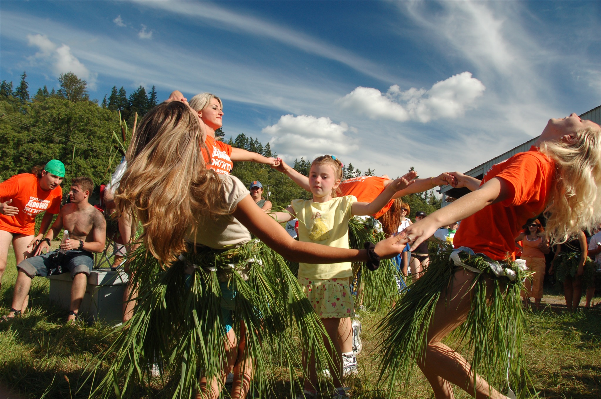
Танец русалок на турслёте "ДроWA" в августе 2007 года.
Mermaids dance at DroWA cultural event in August 2007 near Eatonville, WA.
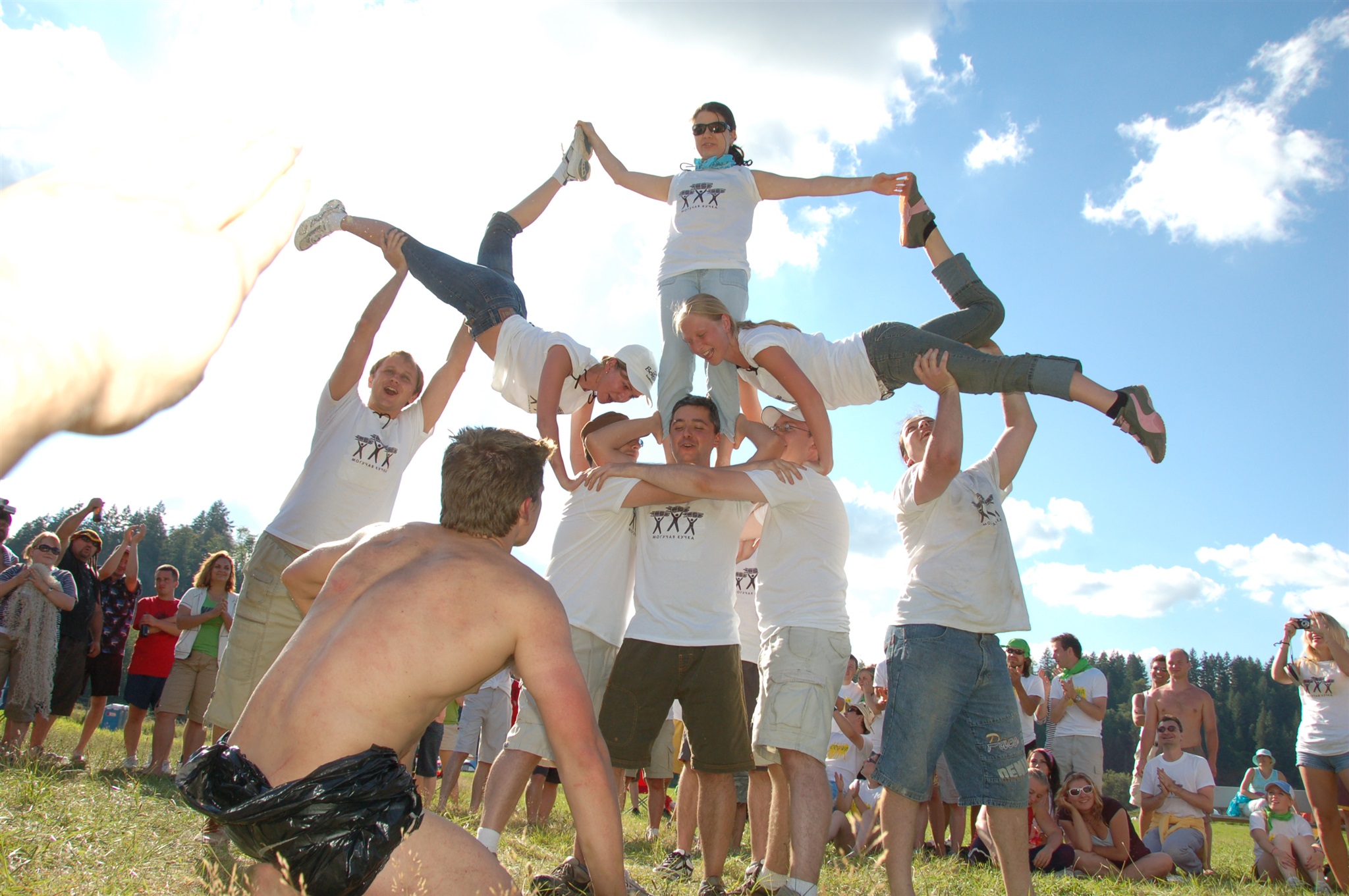
Конкурс пирамид на турслёте "ДроWA" в августе 2007 года.
Live pyramids building contest at DroWA cultural event in August 2007 near Eatonville, WA.
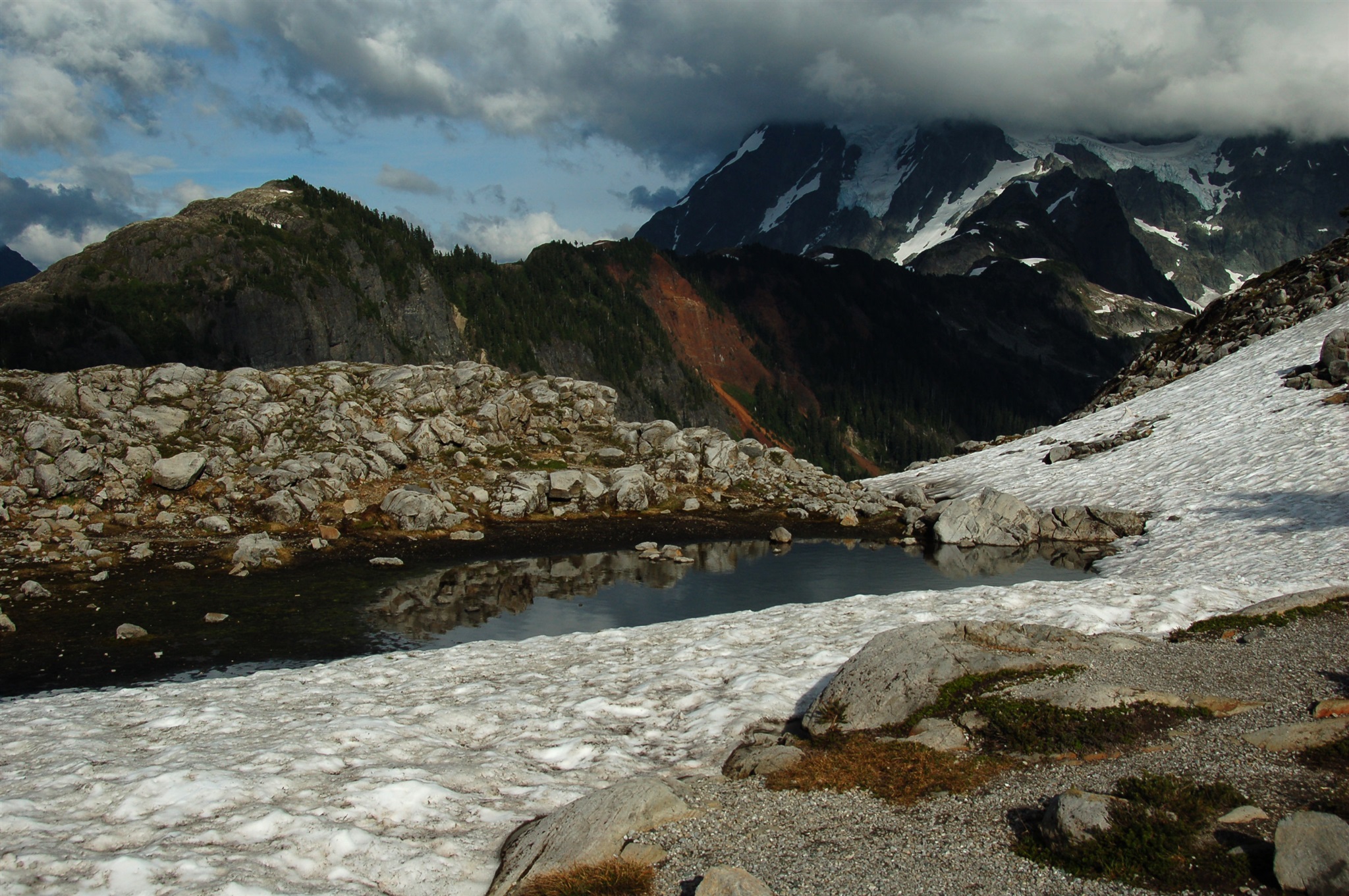
Окрестности горы Shuksan, 1.5 км. над уровнем моря. Ведущая туда дорога под названием Artist Point доступна для проезда лишь пару месяцев в году.
Штат Вашингтон, август 2007.
Near Mt. Shuksan, 0.9 miles above the sea level. The Artist Point road that goes there is accessible for couple of months a year only. WA, August 2007.
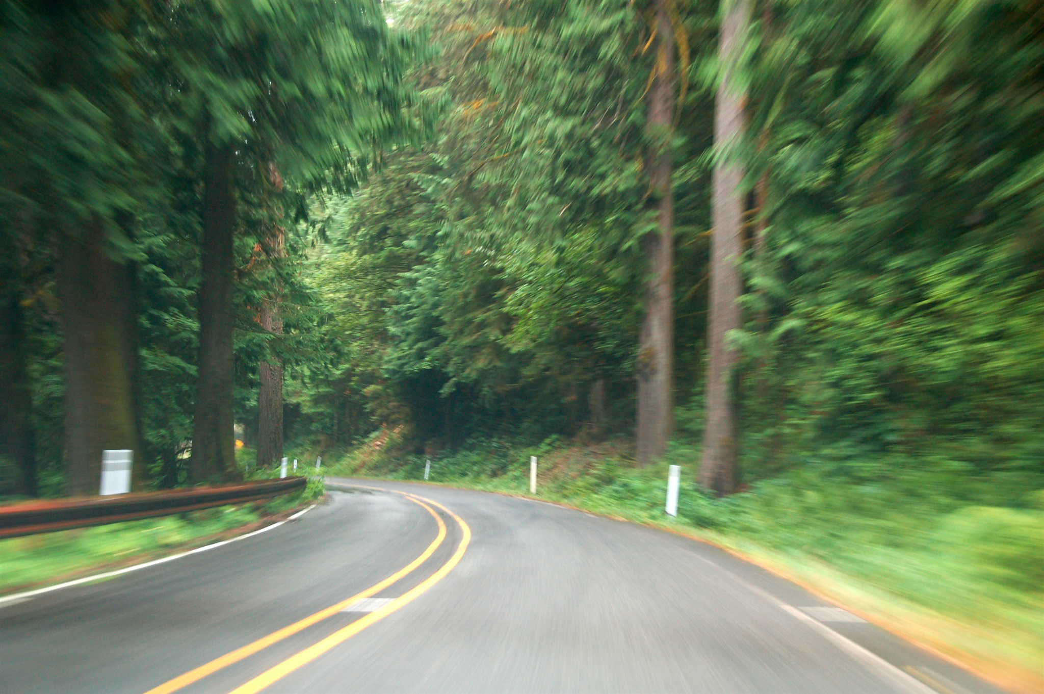
Трасса 542, штат Вашингтон, август 2007.
Highway 542, WA, August 2007.
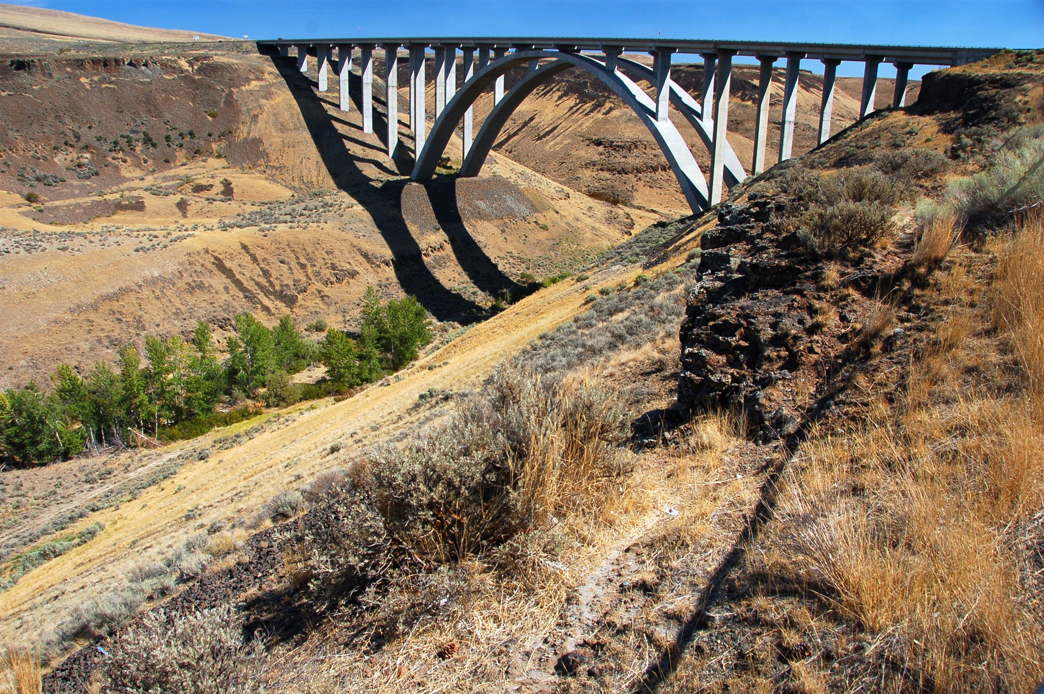
Трасса 82 пересекает каньон возле городка Pomona, штат Вашингтон, сентябрь 2007.
Highway 82 crossing a canyon near Pomona, WA. September 2007.
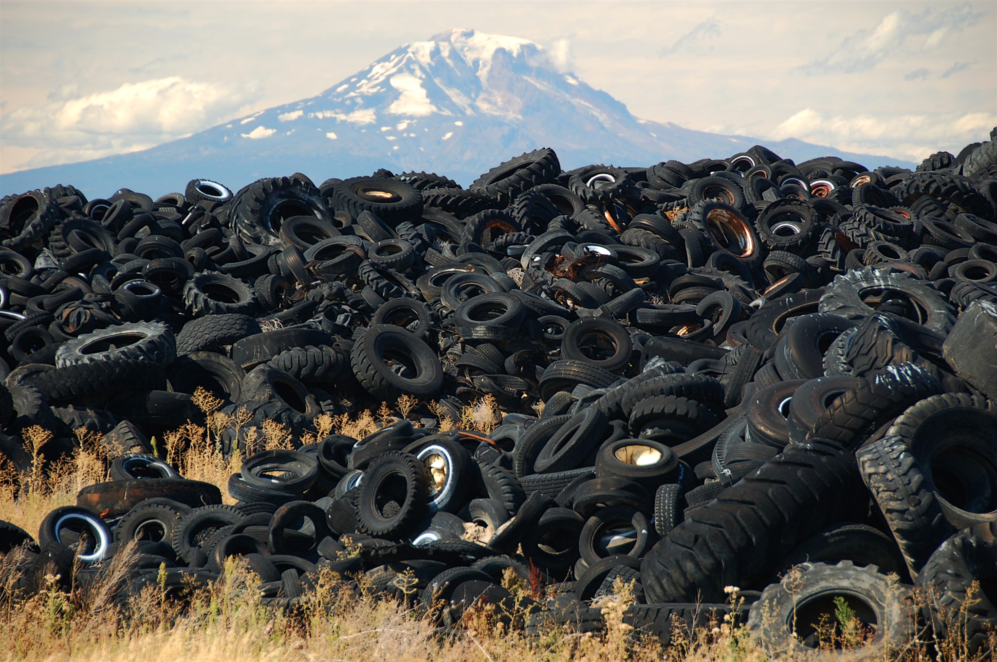
Крупная свалка шин возле городка Голдендейл (Goldendale), штат Вашингтон. На заднем плане, примерно в 100 километрах -- гора Рейнир (Rainier), вид с запада. Если верить весьма ненадёжным данным из интернета, на свалке было более 2-х миллионов шин. Она хорошо видна из космоса: http://maps.google.com/maps?f=q&hl=en&geocode=&q=artist&sll=48.705916,-121.832886&sspn=1.074829,2.202759&ie=UTF8&ll=45.797249,-120.847474&spn=0.004436,0.012124&t=h&z=17. К счастью, над свалкой уже работают. Съездить на неё я хотел с 2005-го года, и когда, наконец, приехал туда, то обнаружил, что 2/3 шин (по сравнению со спутниковыми снимками) уже убрано. Но всё равно зрелище дикое. Сентябрь 2007.
Tire dump near Goldendale, WA. The mountain on the background is Rainier [approx. 60 miles to the east from that point]. According to various [unreliable] sources, there were more than 2 million tires at that site. The piles were so huge that you could easily see them from space (http://maps.google.com/maps?f=q&hl=en&geocode=&q=artist&sll=48.705916,-121.832886&sspn=1.074829,2.202759&ie=UTF8&ll=45.797249,-120.847474&spn=0.004436,0.012124&t=h&z=17). The good news is that the dump is being actively worked upon, at least this is what I saw when I arrived there. About 2/3 of the dump was gone by 09/2007 compared to the satellite images of 2005.
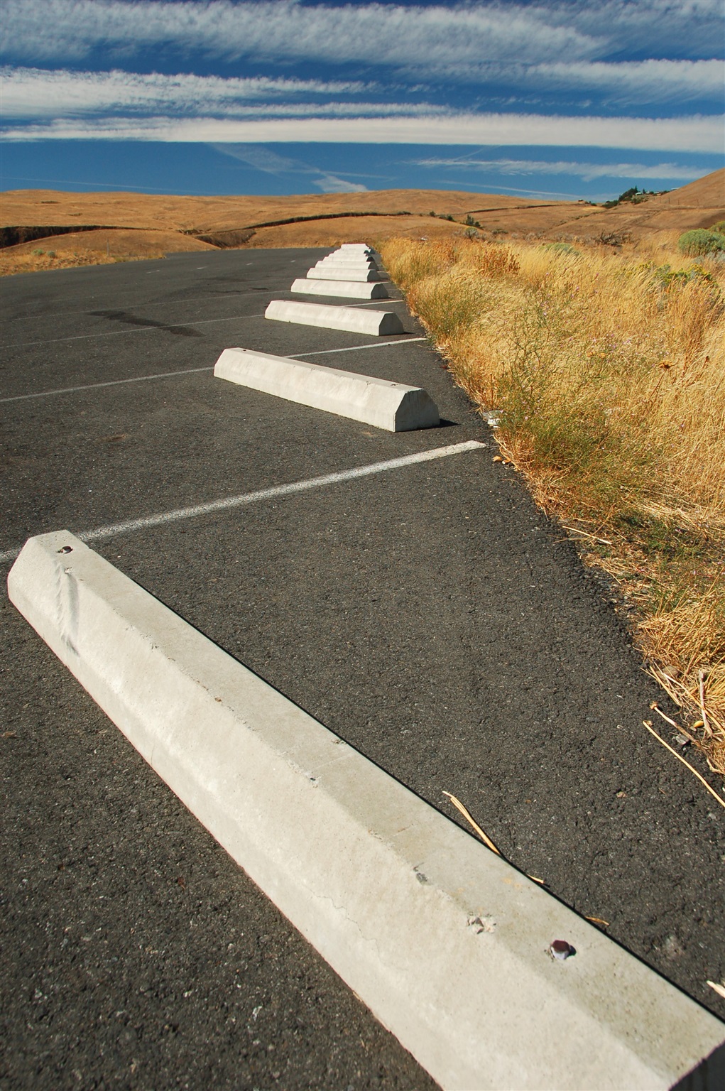
Парковка недалеко от пересечения 97-го и 14-го шоссе, юг штата Вашингтон, сентябрь 2007.
Parking "in the middle of nowhere" near highways 97 and 14 junction, southern WA, September 2007.
Парковка недалеко от пересечения 97-го и 14-го шоссе, юг штата Вашингтон, сентябрь 2007.
Parking "in the middle of nowhere" near highways 97 and 14 junction, southern WA, September 2007.
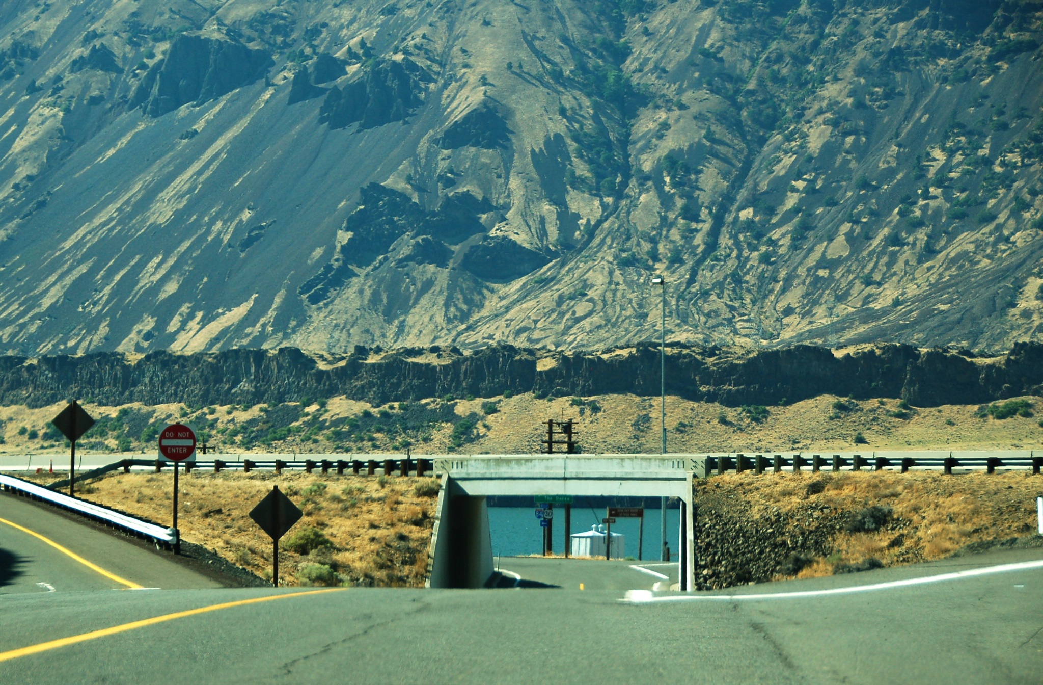
Трасса 84 возле парка Le Page Park. Эта сторона -- штат Орегон, противоположная -- Вашингтон, между ними река Коламбия. Сентябрь 2007.
Highway 84 near Le Page Park, Oregon. On the other side of Columbia River is Washington State. September 2007.
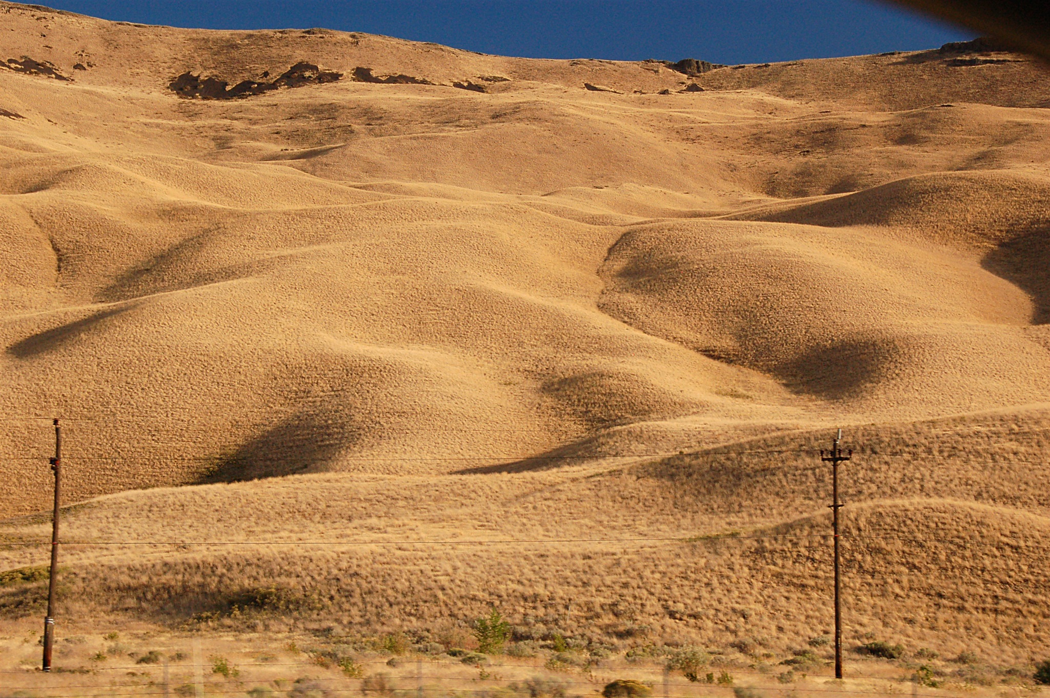
Холмы вдоль трассы 82 между городками Саннисайд (Sunnyside) и Якима (Yakima), штат Вашингтон. Сентябрь 2007.
Rolling hills near highway 82 between Sunnyside and Yakima, WA. September 2007.
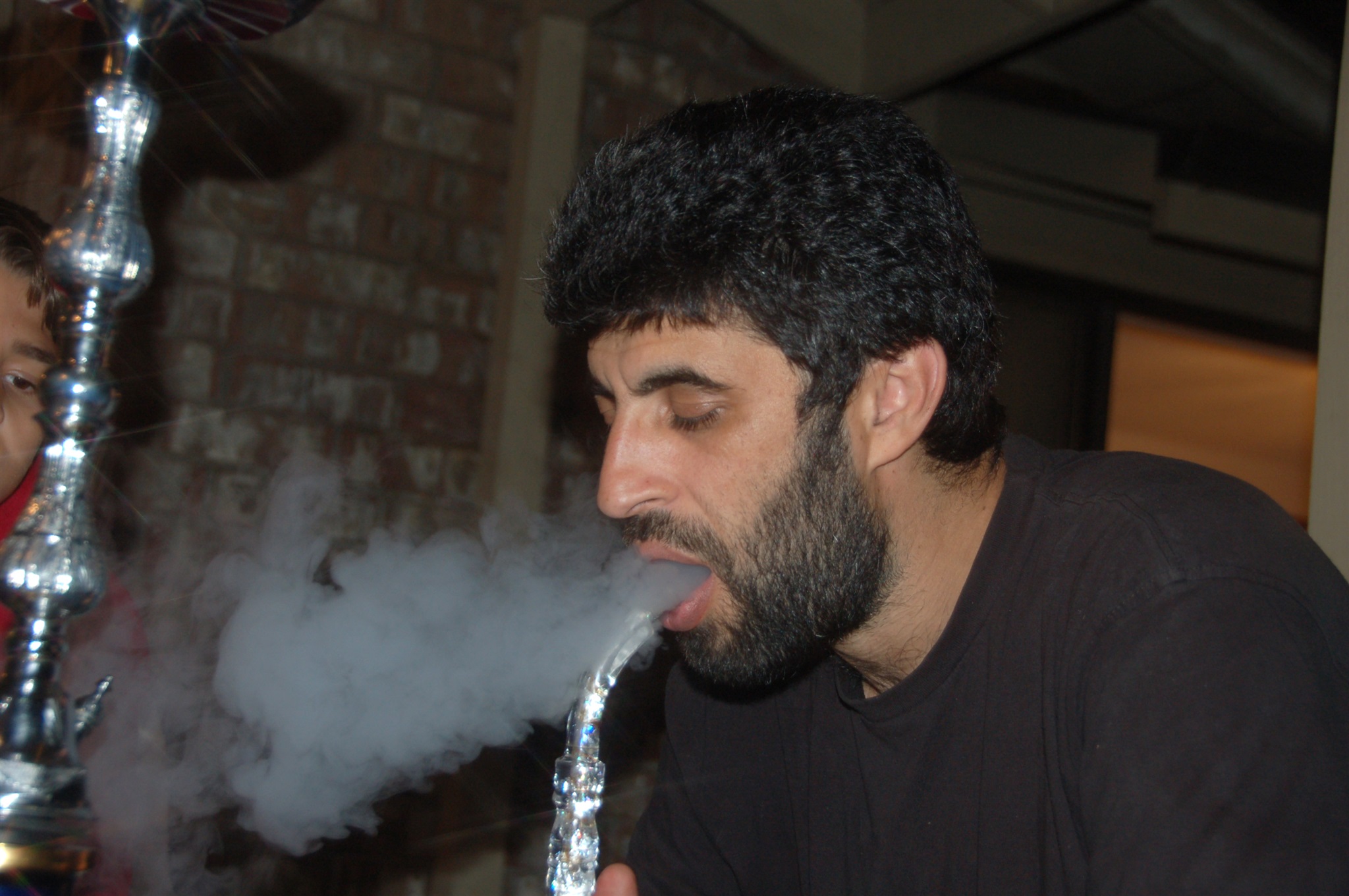
Дани курит кальян. Беллевью, штат Вашингтон, сентябрь 2007.
Dani with the hookah. Bellevue, WA, September 2007.
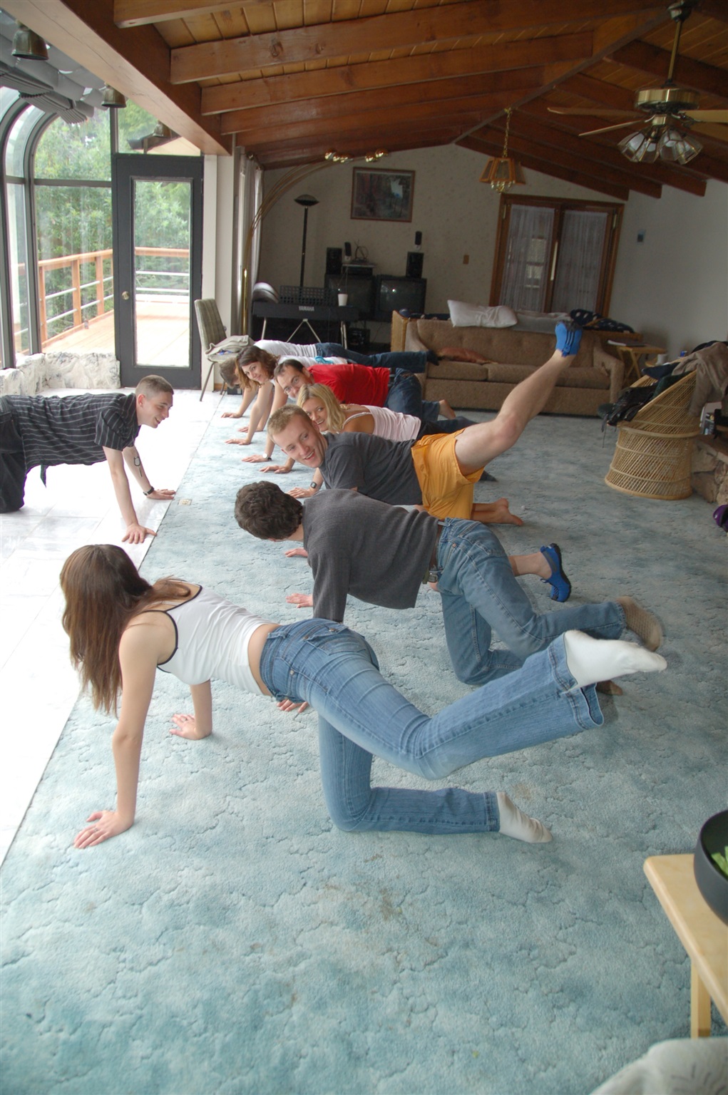
День рождения Андрея на его "даче". Утро "после вчерашнего". Народ делает зарядку под чутким руководством Леонида :) Сентябрь 2007.
Second day of Andrey's birthday celebration at his timeshare house. Guest are doing morning exercises with Leonid coordinating ;) September 2007.
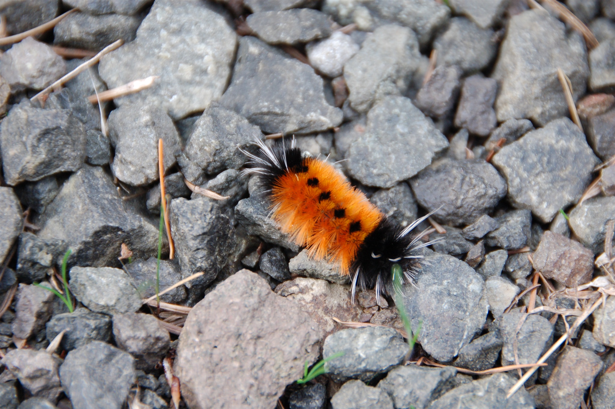
Какая-то гусеница. Сентябрь 2007.
A caterpillar. September 2007.
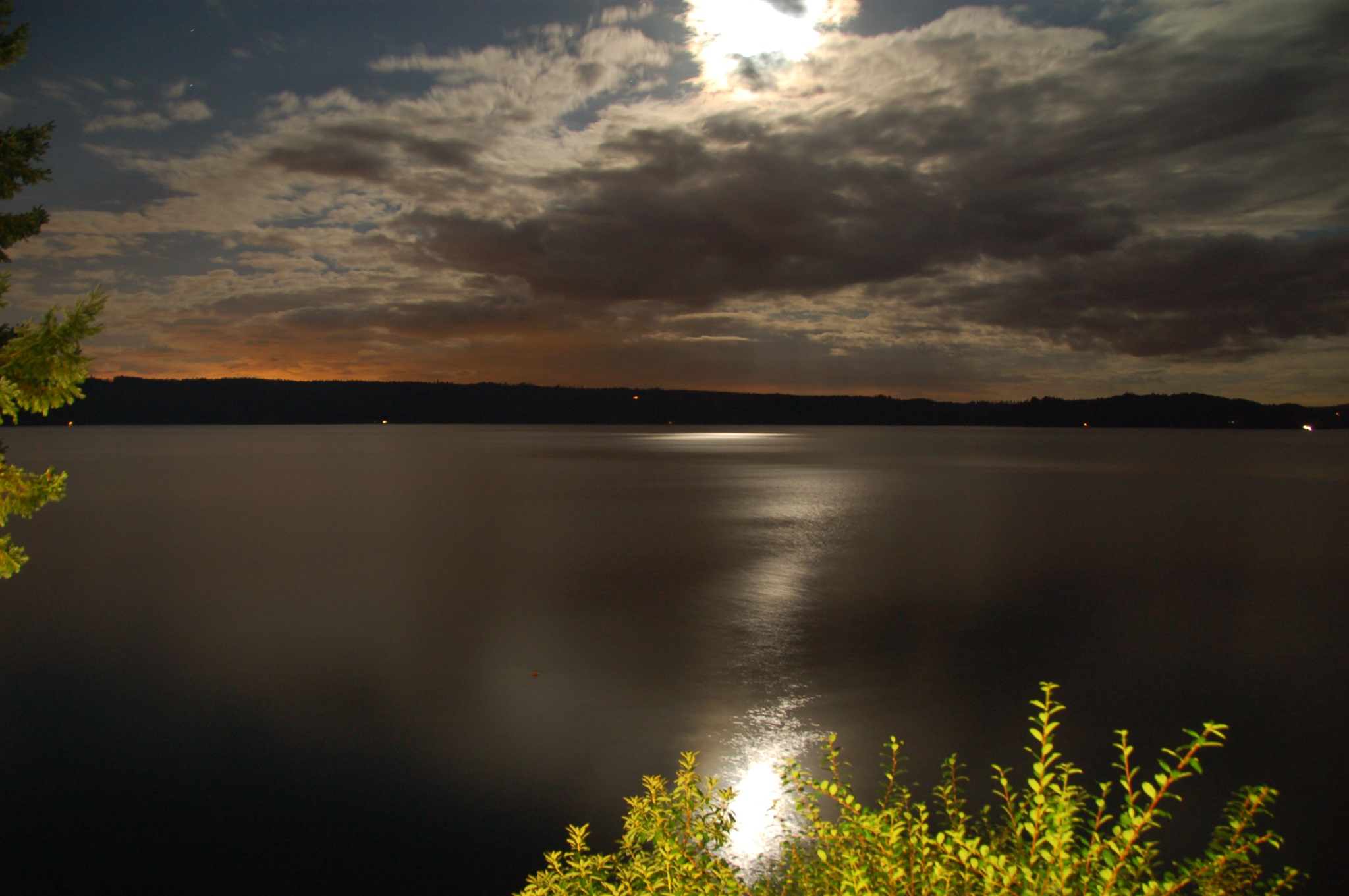
Ночной вид на Hood Canal с побережья полуострова Олимпик (Olympic), вдоль трассы 101. Штат Вашингтон, сентябрь 2007.
Hood Canal at night seen from the Olympic peninsula along highway 101. WA, September 2007.
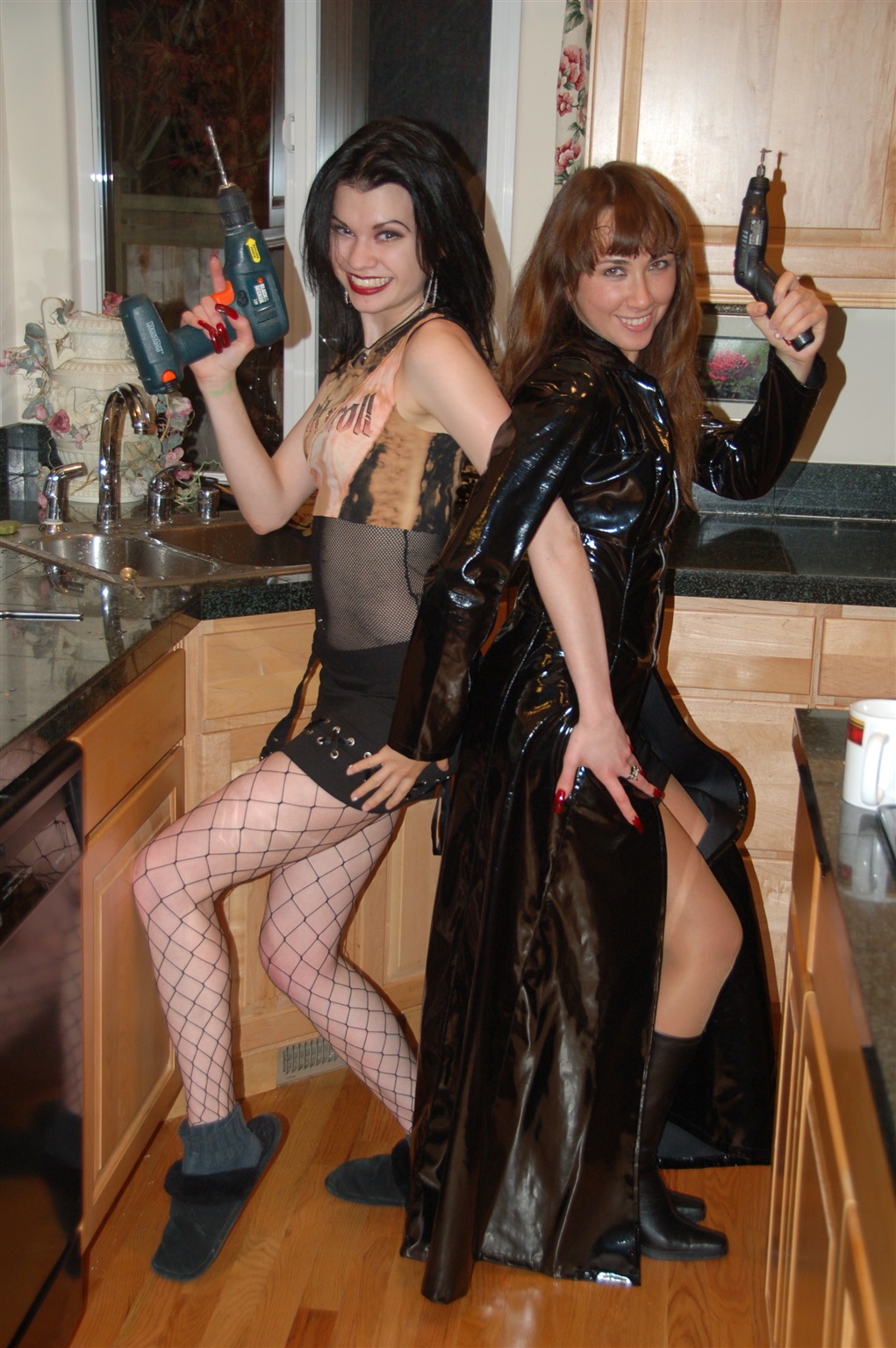
Сентябрь 2007 :))
September 2007 :))
Вадим и Петер на празднике Октоберфест в городке Ливенворс (Leavenworth), штат Вашингтон, октябрь 2007.
Vadim and Pater at Oktoberfest in Leavenworth, WA, October 2007.
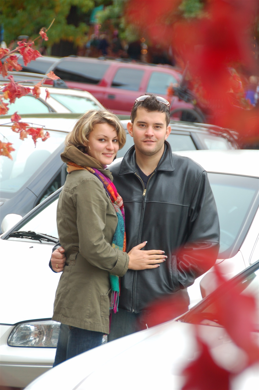
Марина и Антон. Ливенворс (Leavenworth), Вашингтон, октябрь 2007.
Marina and Anton, Leavenworth, WA, October 2007.
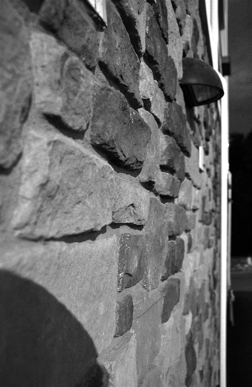
Кирпичная стена. Город Ливенворс (Leavenworth), штат Вашингтон, октябрь 2007.
Brick wall in Leavenworth, WA. October 2007.
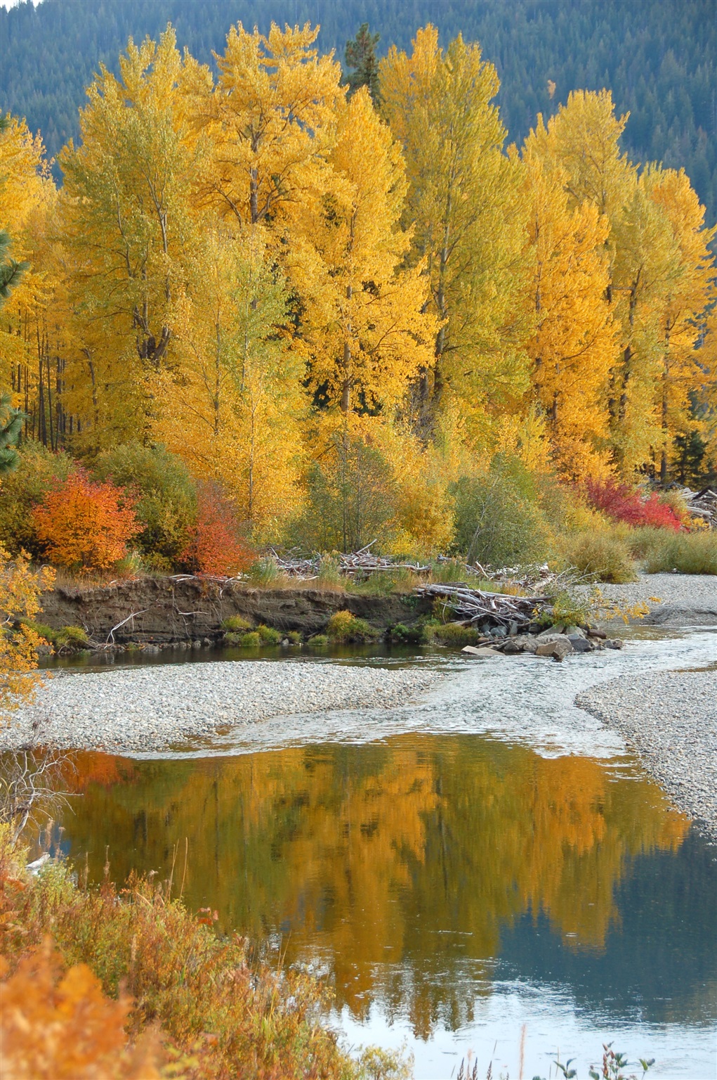
Осенние краски вдоль трассы №2 к востоку от перевала Стивенс (Stevens Pass). Штат Вашингтон, октябрь 2007.
Fall time views near highway 2 to the east of Stevens Pass. WA, October 2007.
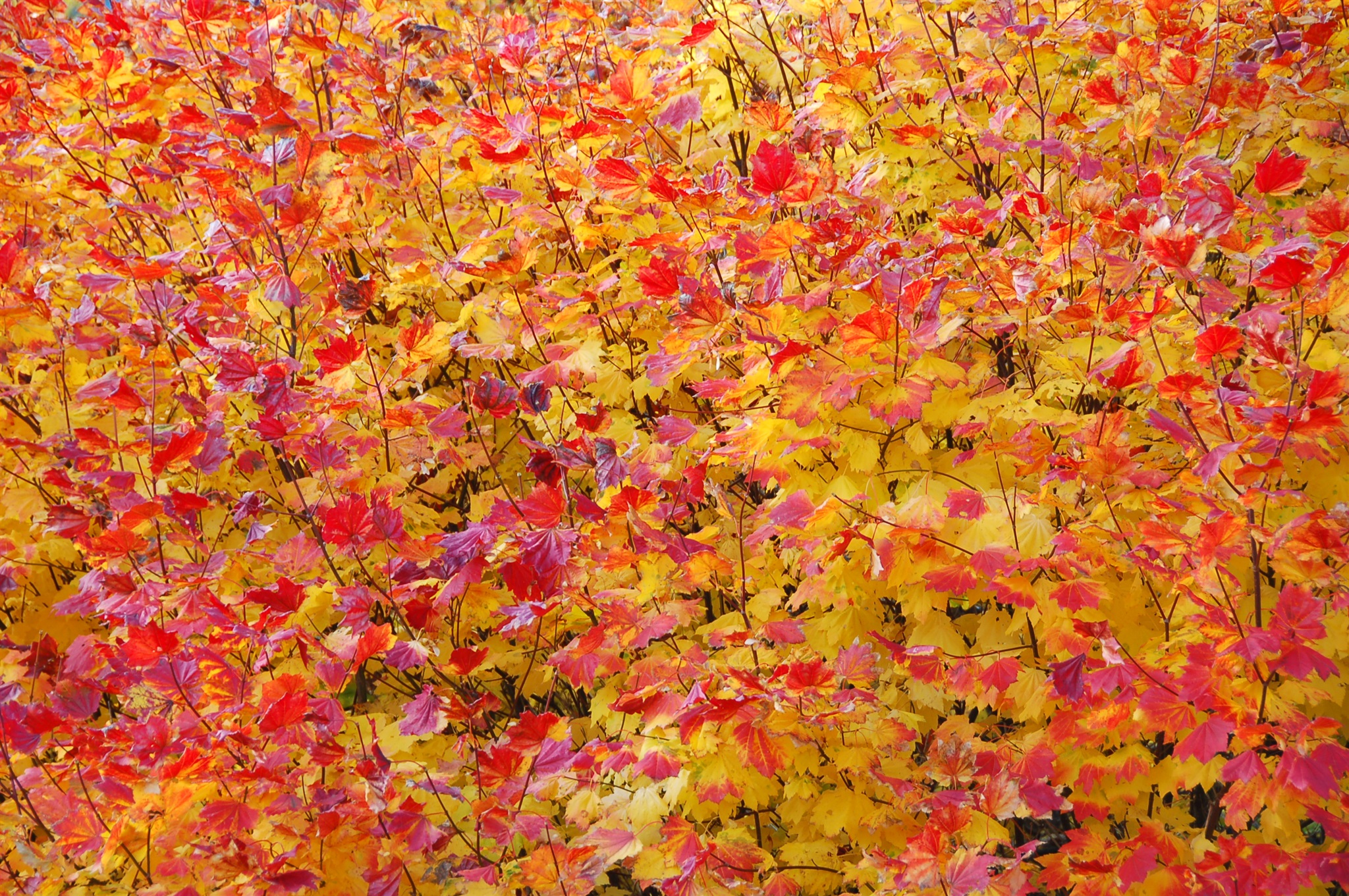
Осенние краски вдоль трассы №2 к востоку от перевала Стивенс (Stevens Pass). Штат Вашингтон, октябрь 2007.
Fall time views near highway 2 to the east of Stevens Pass. WA, October 2007.
Осенние краски вдоль трассы №2 к востоку от перевала Стивенс (Stevens Pass). Штат Вашингтон, октябрь 2007.
Fall time views near highway 2 to the east of Stevens Pass. WA, October 2007.
Осень вдоль трассы №2 у городка Нэйзон Крик (Nason Creek), примерно здесь: http://maps.live.com/default.aspx?v=2&cp=47.773224~-120.817595&style=h&lvl=15&tilt=-90&dir=0&alt=-1000&scene=2854426&trfc=1&encType=1
Штат Вашингтон, октябрь 2007.
Fall time views from highway 2 near Nason Creek, WA, October 2007. Location: http://maps.live.com/default.aspx?v=2&cp=47.773224~-120.817595&style=h&lvl=15&tilt=-90&dir=0&alt=-1000&scene=2854426&trfc=1&encType=1
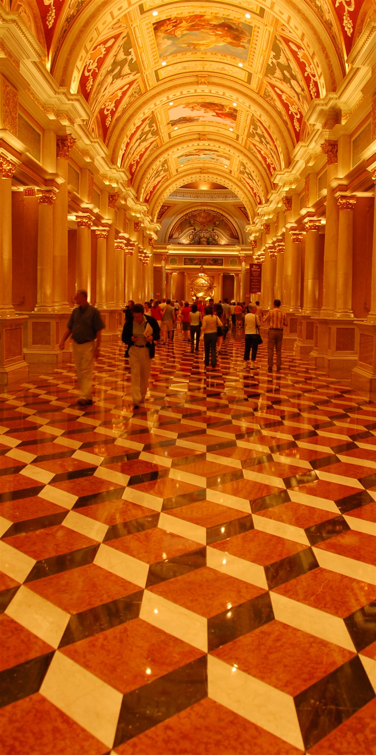
Лас-Вегас, Невада. Отель то ли Venetian, то ли Wynn. Октябрь 2007.
Las Vegas, NV. I forgot which hotel this was -- either Venetian or Wynn.
Отель Мираж (Mirage), Лас-Вегас, штат Невада. Октябрь 2007.
Mirage Hotel, Las Vegas, NV, October 2007.
Яна. Ноябрь 2007.
Yana. November 2007.
Алёна (слева) и Яна (справа). Ноябрь 2007.
Alena (left) and Yana (right). November 2007.
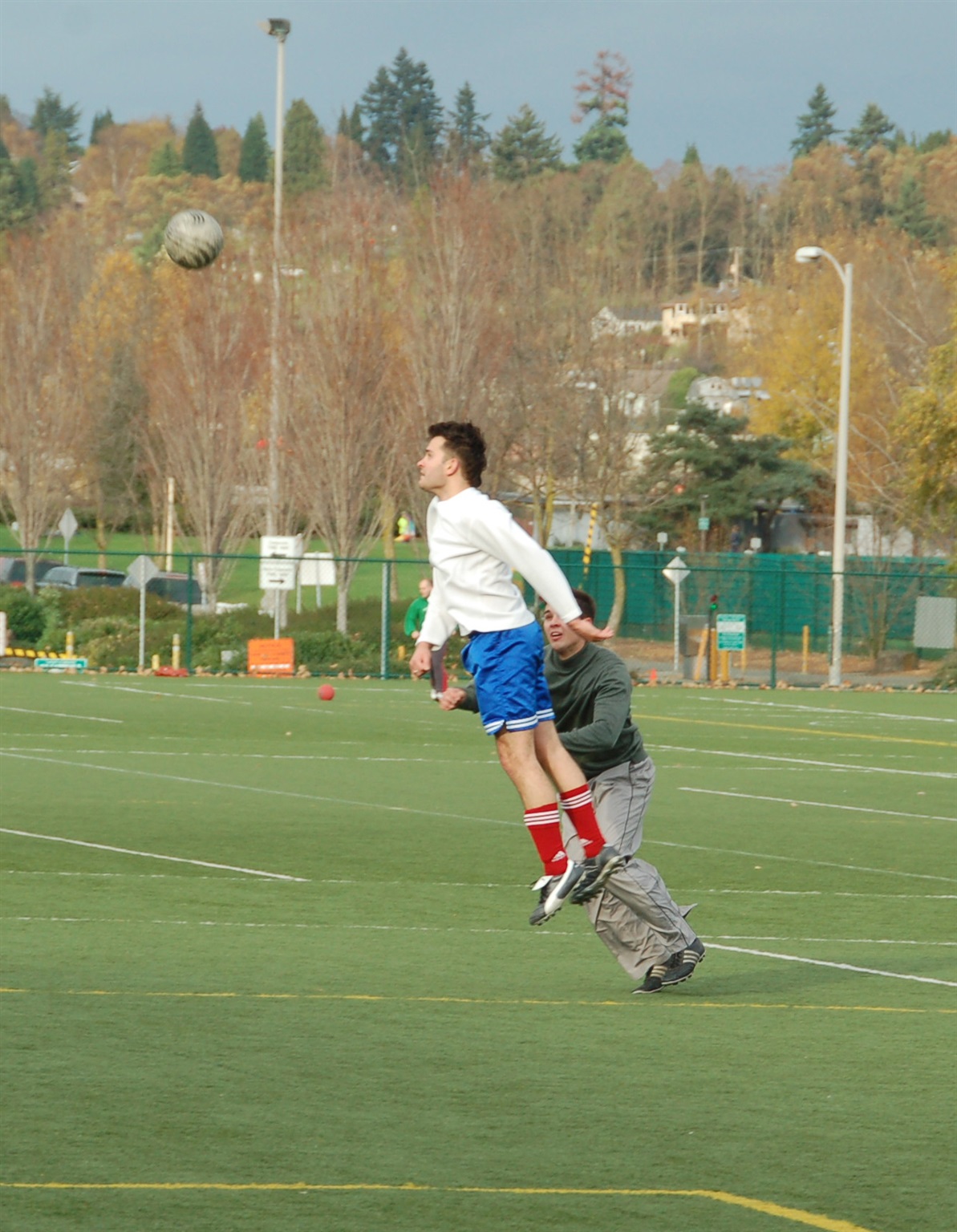
Игра в футбол на поле университета UW, Сиэттл. Антон отбивает мяч, Ваня на заднем плане. Ноябрь 2007.
Soccer game at UW sport fields, Seattle, WA. Anton is hitting the ball, with Ivan on the back running to catch up. November 2007.
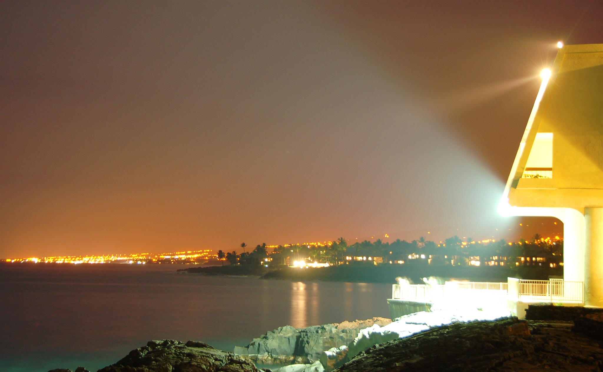
Отель Шератон (Sheraton), город Кеаухоу (Keauhou), западное побережье острова Гавайи, ночной кадр. Ноябрь 2007 г.
Night view near Sheraton hotel, Keauhou, western shore of Big Island, Hawaii. November 2007.
Отель Шератон (Sheraton), город Кеаухоу (Keauhou), западное побережье острова Гавайи, ночной кадр. Ноябрь 2007 г.
Night view near Sheraton hotel, Keauhou, western shore of Big Island, Hawaii. November 2007.
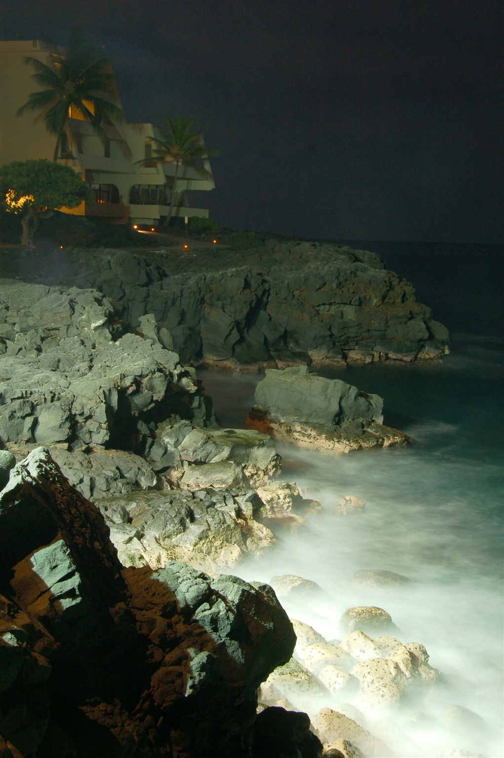
Отель Шератон (Sheraton), город Кеаухоу (Keauhou), западное побережье острова Гавайи, ночной кадр. Ноябрь 2007 г.
Night view near Sheraton hotel, Keauhou, western shore of Big Island, Hawaii. November 2007.
Вид на северо-запад с трассы 190 между городами, простите, Хуехуе (Huehue) и Пууанахулу (Puuanahulu). Остров Гавайи, ноябрь 2007.
North-west view from highway 190 halfway between Huehue and Puuanahulu, Big Island, HI. November 2007.
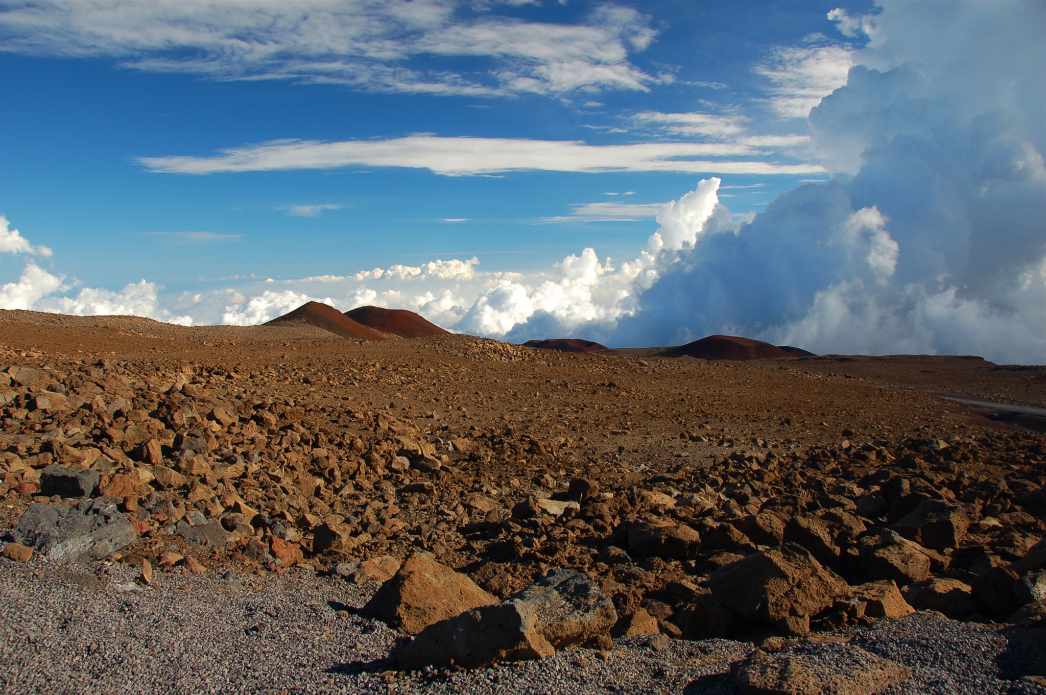
Остров Гавайи, ноябрь 2007. Промежуточная остановка в подъёме на гору Мауна Кеа (Mauna Kea). Высота 3000 метров, примерно вот эта точка: http://maps.live.com/default.aspx?v=2&cp=19.770459~-155.450363&style=a&lvl=15&tilt=-90&dir=0&alt=-1000&scene=2854426&trfc=1&sp=Point.m8vrb521c6ph_1___&encType=1.
Big Island, HI, November 2007. A short stop while driving to the summit of Mauna Kea. Elevation 9800 ft, approximately here: http://maps.live.com/default.aspx?v=2&cp=19.770459~-155.450363&style=a&lvl=15&tilt=-90&dir=0&alt=-1000&scene=2854426&trfc=1&sp=Point.m8vrb521c6ph_1___&encType=1
Остров Гавайи, ноябрь 2007. Промежуточная остановка при подъёме на гору Mauna Kea. Высота 3900 метров, примерно здесь: http://maps.live.com/default.aspx?v=2&cp=19.812859~-155.468431&style=a&lvl=15&tilt=-90&dir=0&alt=-1000&scene=2854426&trfc=1&sp=Point.m91jyv219xhw_1___&encType=1
Big Island, Hawaii, November 2007. A short stop while driving to the summit of Mauna Kea. Elevation 12800 ft, approximately here: http://maps.live.com/default.aspx?v=2&cp=19.812859~-155.468431&style=a&lvl=15&tilt=-90&dir=0&alt=-1000&scene=2854426&trfc=1&sp=Point.m91jyv219xhw_1___&encType=1
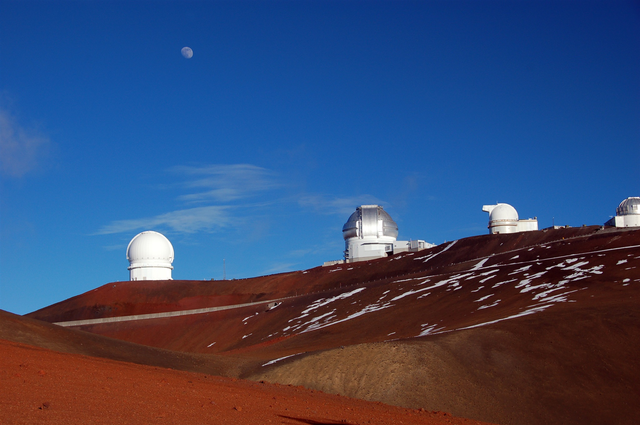
Остров Гавайи, вершина горы Мауна Кеа (Mauna Kea). Вид на телескоп Subaru. Высота 4100 метров, вот здесь: http://maps.live.com/default.aspx?v=2&cp=19.824285~-155.477464&style=a&lvl=17&tilt=-90&dir=0&alt=-1000&scene=2854426&trfc=1&sp=Point.m93mr0219621_1___&encType=1
Ноябрь 2007.
Big Island, Hawaii, Mauna Kea summit. In the distance, Subaru Telescope is seen. Location: http://maps.live.com/default.aspx?v=2&cp=19.824285~-155.477464&style=a&lvl=17&tilt=-90&dir=0&alt=-1000&scene=2854426&trfc=1&sp=Point.m93mr0219621_1___&encType=1
November 2007.
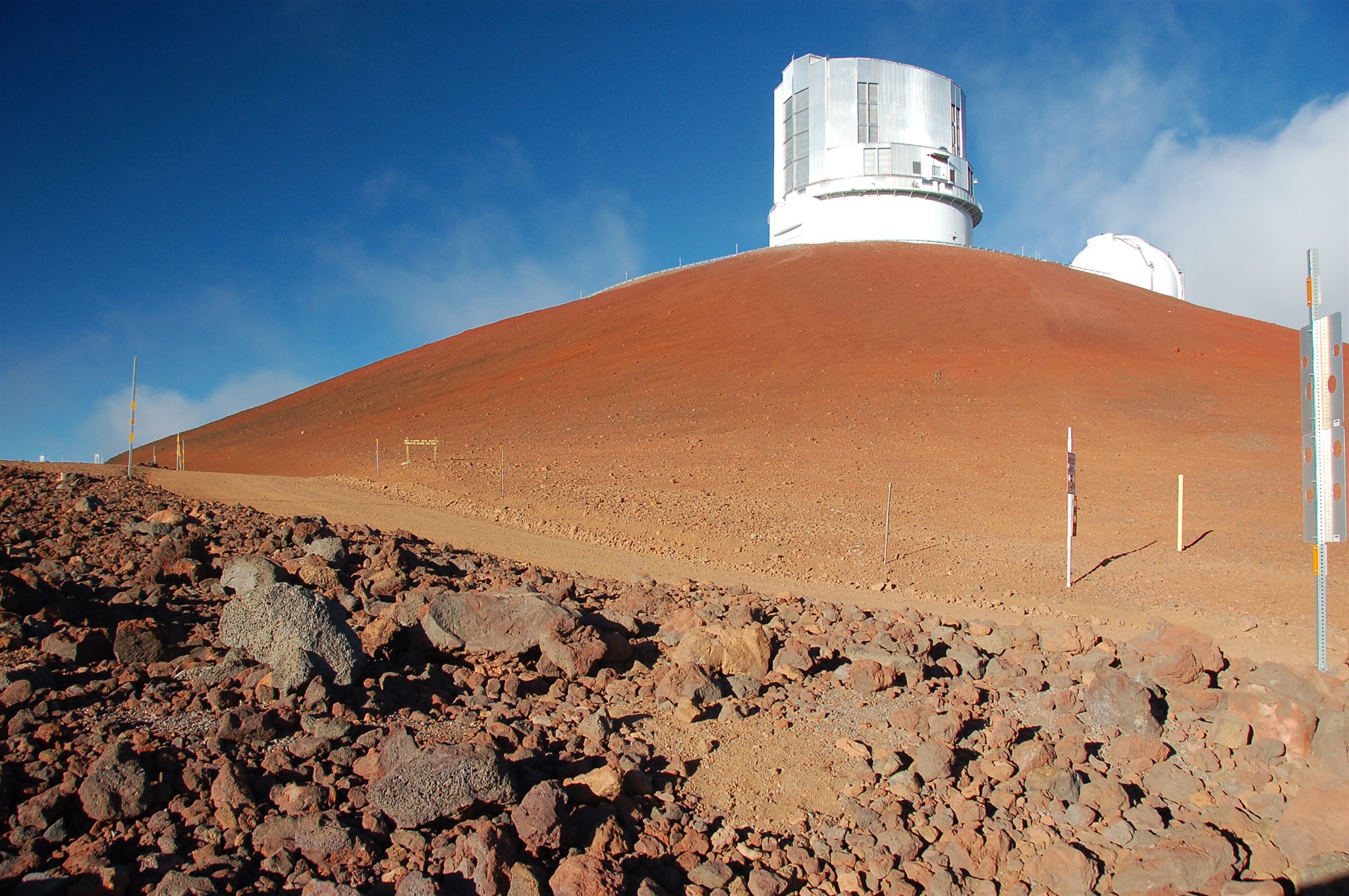
Остров Гавайи (Big Island), вершина горы Мауна Кеа (Mauna Kea). Высота 4100 метров, вот здесь: http://maps.live.com/default.aspx?v=2&cp=19.824285~-155.477464&style=a&lvl=17&tilt=-90&dir=0&alt=-1000&scene=2854426&trfc=1&sp=Point.m93mr0219621_1___&encType=1
Ноябрь 2007.
Big Island, Hawaii, Mauna Kea summit. Location: http://maps.live.com/default.aspx?v=2&cp=19.824285~-155.477464&style=a&lvl=17&tilt=-90&dir=0&alt=-1000&scene=2854426&trfc=1&sp=Point.m93mr0219621_1___&encType=1
November 2007.
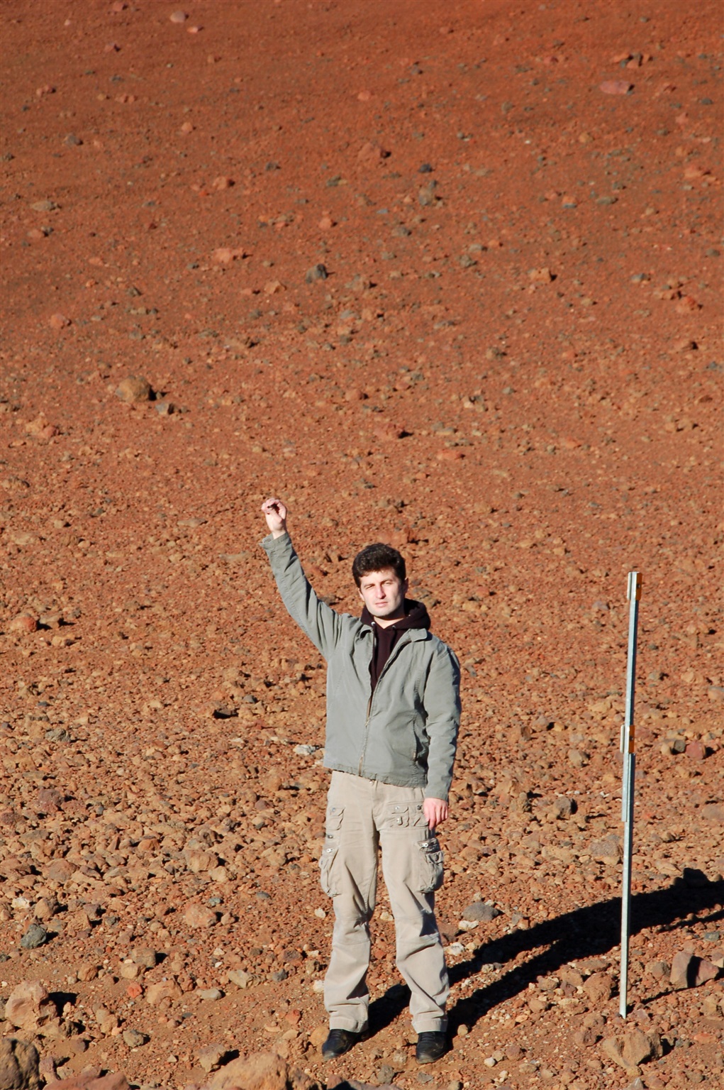
Остров Гавайи (Big Island), вершина горы Мауна Кеа (Mauna Kea). Кадр "Бобух на Марсе". Высота 4100 метров, карта: http://maps.live.com/default.aspx?v=2&cp=19.824285~-155.477464&style=a&lvl=17&tilt=-90&dir=0&alt=-1000&scene=2854426&trfc=1&sp=Point.m93mr0219621_1___&encType=1
Ноябрь 2007.
Big Island, Hawaii, Mauna Kea summit. I'm pretending to be on Mars at this location: http://maps.live.com/default.aspx?v=2&cp=19.824285~-155.477464&style=a&lvl=17&tilt=-90&dir=0&alt=-1000&scene=2854426&trfc=1&sp=Point.m93mr0219621_1___&encType=1
November 2007.
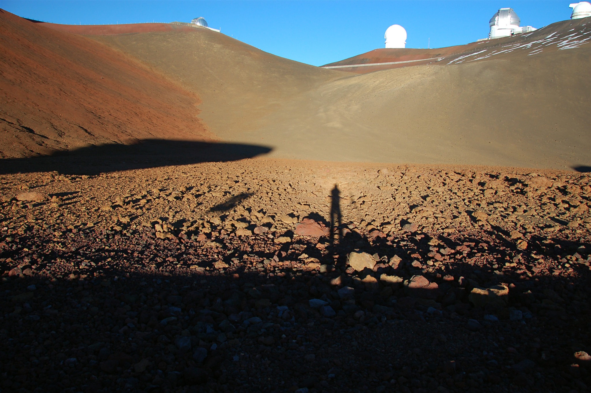
Остров Гавайи (Big Island), вершина горы Мауна Кеа (Mauna Kea), марсианский пейзаж. Высота 4100 метров, вот здесь: http://maps.live.com/default.aspx?v=2&cp=19.823891~-155.475748&style=a&lvl=17&tilt=-90&dir=0&alt=-1000&scene=2854426&trfc=1&sp=Point.m93gdp2199qd_1___&encType=1
Ноябрь 2007.
Big Island, Hawaii, Mauna Kea summit, elevation 13400 ft. "Martian" landscape at this location: http://maps.live.com/default.aspx?v=2&cp=19.823891~-155.475748&style=a&lvl=17&tilt=-90&dir=0&alt=-1000&scene=2854426&trfc=1&sp=Point.m93gdp2199qd_1___&encType=1
November 2007.
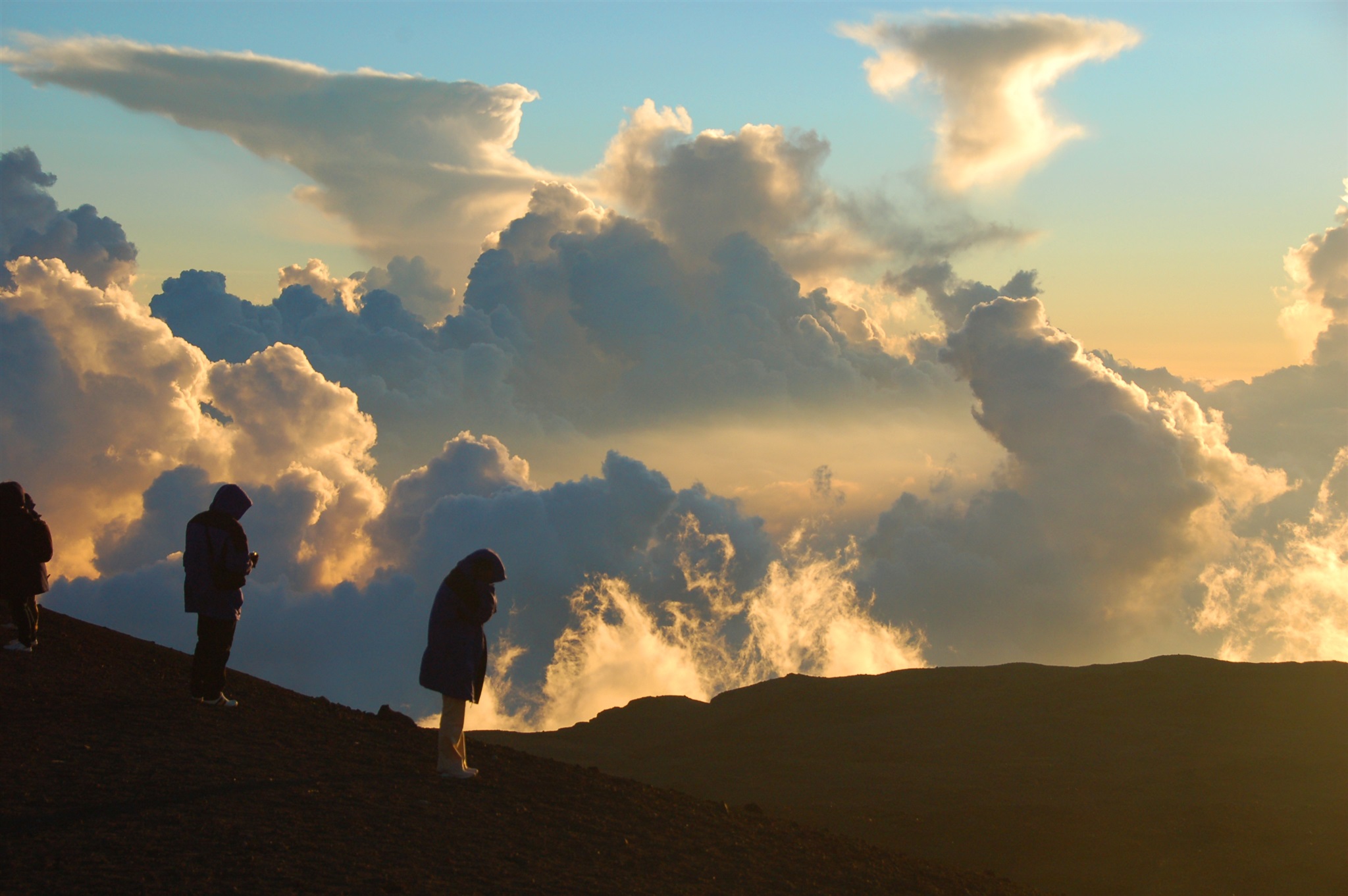
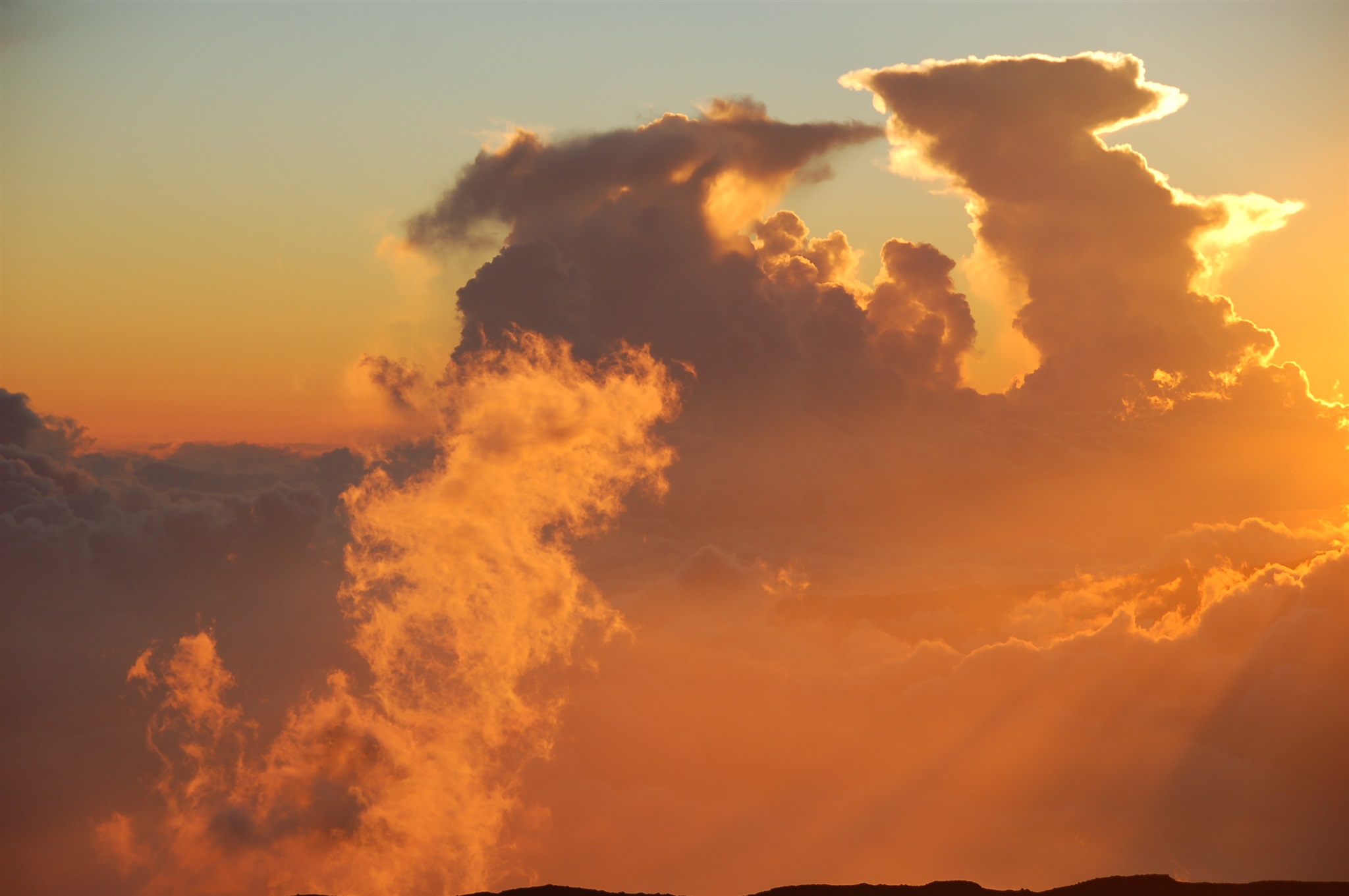
Закат солнца на вершине горы Мауна Кеа (Mauna Kea), остров Гавайи (Big Island). Высота 4200 метров, температура -3 С, кислорода 58% от нормы. На переднем плане -- туристы, их туда привозят на автобусе. Ноябрь 2007 г. Координаты: http://maps.live.com/default.aspx?v=2&cp=19.822407~-155.470158&style=a&lvl=17&tilt=-90&dir=0&alt=-1000&scene=2854426&trfc=1&sp=Point.m93d0f219r9d_1___&encType=1
Sunset at Mauna Kea summit, Big Island, Hawaii. Elevation 13750 ft, air temperature 27 F, oxygen content 58% of sea level. Many tourists are delivered there on the buses to see the sunset. November 2007, this point: http://maps.live.com/default.aspx?v=2&cp=19.822407~-155.470158&style=a&lvl=17&tilt=-90&dir=0&alt=-1000&scene=2854426&trfc=1&sp=Point.m93d0f219r9d_1___&encType=1
Закат солнца на вершине горы Мауна Кеа (Mauna Kea), остров Гавайи (Big Island). Высота 4200 метров. Ноябрь 2007 г. Координаты: http://maps.live.com/default.aspx?v=2&cp=19.822407~-155.470158&style=a&lvl=17&tilt=-90&dir=0&alt=-1000&scene=2854426&trfc=1&sp=Point.m93d0f219r9d_1___&encType=1
Sunset viewed from Mauna Kea summit, Big Island, Hawaii. Elevation 13750 ft. November 2007, this point: http://maps.live.com/default.aspx?v=2&cp=19.822407~-155.470158&style=a&lvl=17&tilt=-90&dir=0&alt=-1000&scene=2854426&trfc=1&sp=Point.m93d0f219r9d_1___&encType=1
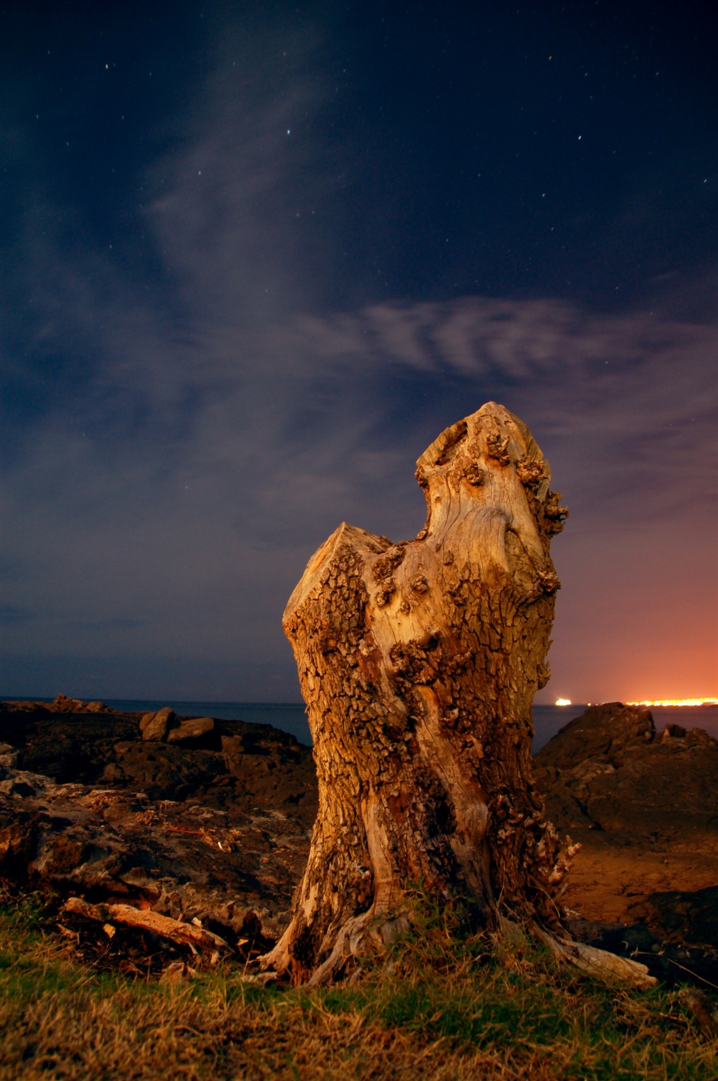
Радуга над дорогой в парке Hawaii Volcanoes National Park, остров Гавайи (Big Island). Ноябрь 2007.
Rainbow over the road seen in Hawaii Volcanoes National Park, Big Island, Hawaii. November 2007.
Стена здания №27. Майкрософт, Редмонд, штат Вашингтон, июнь 2007.
Building 27, Microsoft, Redmond, WA, June 2007.
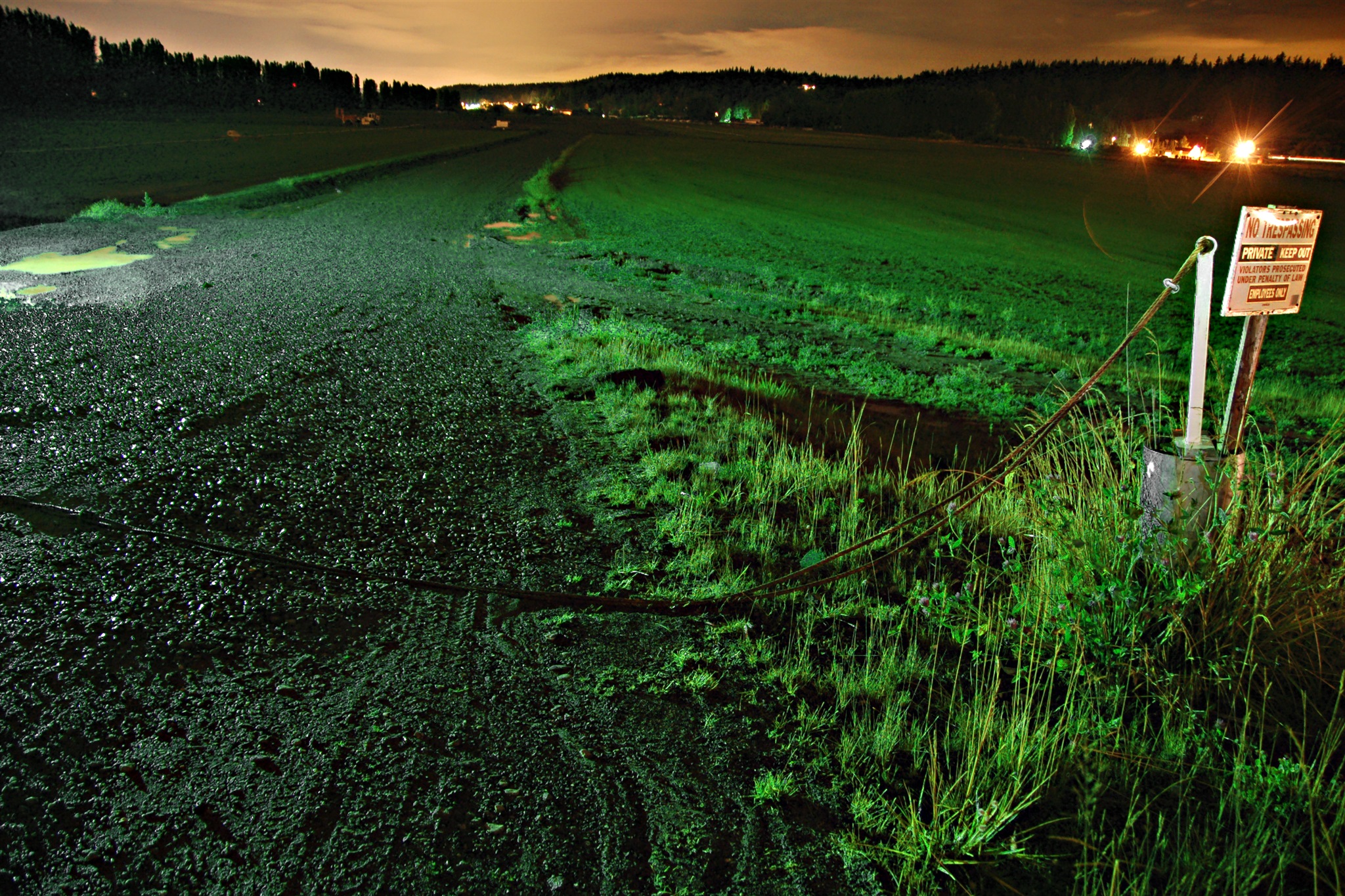
Ночной вид неподалёку от пересечения реки Саммамиш (Sammamish) и 124-й улице, Редмонд, штат Вашингтон, июль 2007.
Night view near the intersection of Sammamish River and NE 124th St, Redmond, WA. July 2007.